The deck sits 173 metres above the water, and that single number is why the Kokonoe Yume Otsurihashi is still Japan's highest pedestrian suspension bridge — but it is no longer the longest: the Mishima Skywalk (400m, 2015) and Osaka's GODA BRIDGE (420m, March 2025) have both overtaken its 390-metre span. Admission is ¥500 for junior-high age and up and ¥200 for elementary students, and the round-trip walk takes roughly 20 to 40 minutes. Using official verification from July 2026, this guide covers the ticket, the different last-entry times in October versus November, the exact wind and fog conditions that shut the bridge, how to reach it by community bus or the Nishitetsu package from Fukuoka, and the story of a small town that built a 2-billion-yen bridge with no national subsidy at all. It also answers the blunt question honestly: whether this is worth a special trip from Fukuoka, or only worth folding into a route you were already driving.
📍 The bridge sits inland in Oita's Kokonoe Town, and the natural way to slot it in is on the Yufuin–Beppu hot-spring circuit: see the Yufuin onsen guide and the Beppu onsen guide. For a second inland Oita gorge on the same autumn line, see the Yabakei guide.
- Highest, not longest: 173m still makes it Japan's highest pedestrian suspension bridge, but its 390m span was passed in 2025 by GODA BRIDGE (420m) and by the Mishima Skywalk (400m)
- Tickets and hours: ¥500 for junior-high age and up, ¥200 for elementary students, preschoolers free; 8:30–18:00 from July to October, 8:30–17:00 the rest of the year, with ticket sales ending 30 minutes before closing
- The November trap: October lets you stay until 18:00, but from November 1 last entry is 16:30 — the single most common autumn scheduling mistake here
- Weather can shut it: sustained wind of 15m/s or more, dense fog, heavy-rain or flood advisories, heavy-snow advisories, or a seismic intensity 4 earthquake can all restrict entry
- Easiest car-free option: the Nishitetsu Kokonoe Yume Otsurihashi Kippu from Fukuoka, 7,600 yen all-in, valid April 4 to November 29, 2026, phone reservation required
📖 Table of Contents (click to expand)
- What 173 metres actually means: highest, not longest
- Tickets and hours: the 16:30 November trap
- Weather limits and vertigo: when you cannot cross
- What you actually see: Shindo Falls and Kyusuikei
- Which entrance: Nakamura vs Kitagata
- Access: community bus, Nishitetsu package, driving
- How it got built: a 1956 idea and a 2-billion-yen gamble
- Planning autumn: peak timing, crowds, timing traps
- Worth a special trip? An honest verdict
- FAQ
What 173 metres actually means: highest, not longest
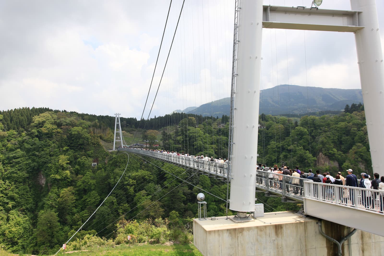
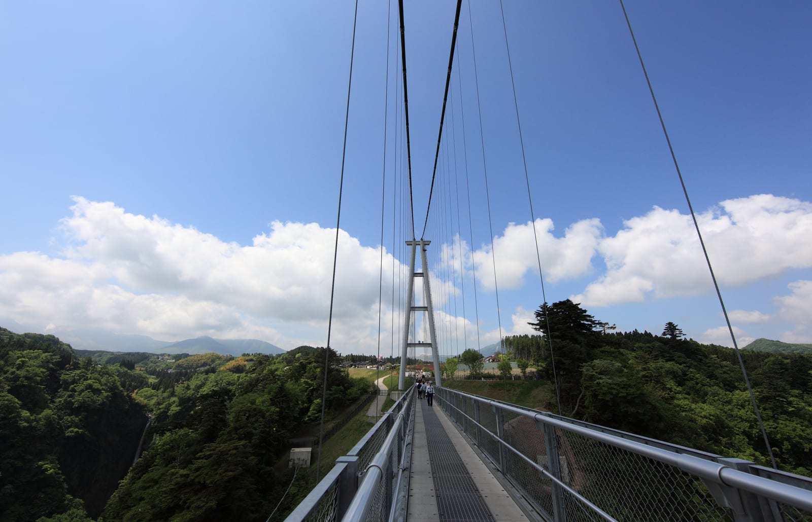
Start with the claim that has quietly expired:the Kokonoe Yume Otsurihashi is not Japan's longest suspension bridge any more, but it is still the highest pedestrian one.
The official specifications are a main span of 390 metres, a total length including approach sections of 435 metres, a deck 173 metres above the water, and a width of 1.5 metres. It is pedestrian-only, and it was engineered to carry 1,800 adults at once. When it opened in 2006, that 390-metre span genuinely was the longest pedestrian suspension bridge in the country, and the phrase "Japan's number one" got copied into travel writing for the next two decades. The length ranking has since been overturned twice: the Mishima Skywalk in Shizuoka opened in 2015 with a 400-metre span, and GODA BRIDGE in Ibaraki City, Osaka opened in March 2025 at 420 metres. Kokonoe now sits around third by span.
| Bridge | Main span | Total length | Height | Location | Opened |
|---|---|---|---|---|---|
| GODA BRIDGE | 420m | 420m | not verified here | Ibaraki, Osaka | March 2025 |
| Mishima Skywalk | 400m | 640m | not verified here | Mishima, Shizuoka | 2015 |
| Kokonoe Yume Otsurihashi | 390m | 435m | 173m (highest in Japan) | Kokonoe, Oita | 2006 |
| Ryujin Otsurihashi | 375m | 446m | not verified here | Hitachiota, Ibaraki | 1994 |
Only the Kokonoe row carries a height figure because only Kokonoe's official specifications were verified for this guide; the other three heights were outside the scope of this check, so they are left blank rather than filled from memory. What is worth noticing is that the operator's own wording is careful: the official site claims the title of "the greatest height for a pedestrian-only bridge in Japan," and pointedly does not claim the length record any more. That restraint tells you something useful — the town is not propping up a title it has already lost.
So what does 173 metres feel like? The deck is only 1.5 metres wide, with railings above head height and suspension cables slicing the view into vertical slices. On breezy days there is noticeable movement, well within the design envelope but very much perceptible. The real gut-punch is the grating section in the middle of the deck, where the floor is open mesh and the gorge is directly visible under your shoes. That is a design fact rather than an official warning, and it is the reason the vertigo question gets its own section below.
Tickets and hours: the 16:30 November trap
Pricing is refreshingly simple, and there is no peak-season surcharge — unusual for a headline foliage attraction:
- Junior-high age and up: ¥500
- Elementary students: ¥200
- Preschool age: free
- Visitors with a disability: half price, including one companion
- Groups of 30 or more: 10 percent off the base rate (an existing policy, not a new one)
One forward-looking note, and only one: Kokonoe Town has published a revised admission structure effective January 1, 2027, adding discounts for town residents, school excursions and similar categories. Ordinary visitors are unaffected, so nobody needs to reschedule a 2026 trip around it.
Hours are where the planning risk lives, because they split into two seasons and ticket sales stop 30 minutes before the gate does:
| Period | Open | Last tickets |
|---|---|---|
| July–October | 8:30–18:00 | 17:30 |
| November–December, January–June | 8:30–17:00 | 16:30 |
This is the most practically useful warning in the whole guide. Kokonoe's foliage peak straddles late October into mid-November, which means the same wave of autumn colour sits on both sides of the schedule change. Come in October and you can linger until 18:00 with tickets sold until 17:30. Turn the calendar to November 1 and last entry drops instantly to 16:30. Plenty of people plan an autumn afternoon on the assumption that "there will still be light at five," drive over from Yufuin with a couple of stops on the way, roll into the car park at 16:40 — and find the ticket window shut. If you are visiting in November, aim to arrive by about 15:30, and work backwards from that when you set your departure time, allowing generously for winding mountain roads.
There is also no fixed weekly closing day — the official listing for regular holidays reads "none." That does not mean it is guaranteed open, though, because weather intervenes, which is the next section.
Weather limits and vertigo: when you cannot cross
⚠️ Official statement: entry may be restricted in bad weather.
The conditions listed are sustained winds of 15 m/s or more, dense fog, a heavy-rain or flood advisory or above, a heavy-snow advisory, and earthquakes of seismic intensity 4 or higher. Check the forecast on the day, or call the management centre on 0973-73-3800. Source: yumeooturihashi.com (verified July 2026).
No fixed closing day, but this is a pedestrian bridge strung across a highland gorge, and the weather decides whether it opens. Of the conditions listed, the two that actually catch travellers out are strong wind and fog. Autumn and winter mornings around Kokonoe are frequently foggy, and fog is doubly punishing: it can restrict entry outright, and even when the bridge is open a thick morning can leave you paying, crossing, and looking at a wall of white where the waterfall should be. If the entire point of your visit is the gorge and the falls, and the forecast says fog, the smart move is to reorder the day — hit an onsen first and come back once it has burned off.
As of the July 2026 verification, the official notice board carried no 2026 construction work, no road closures and no temporary closures. The most recent single-day closure on record was in February 2025, and the most recent works were repaving the Nakamura-area observation plaza in late 2024, long since finished. In other words there is no known structural disruption to plan around right now — the only variable is the sky.
On vertigo, an honest answer rather than a reassuring one. The middle of the deck is open grating with 173 metres of nothing underneath, and the operator has published no official warning about it, so this guide will not invent one. What helps in practice: walk the solid strips nearer the railings and keep your gaze fixed on the far side and the waterfall instead of your feet; avoid genuinely windy days, since deck movement multiplies the anxiety; and keep a firm hand on children at the grating, which is precisely where they will want to crouch and press their faces to the mesh. If heights are a hard no for you, the observation plaza on the Nakamura side still delivers gorge scenery without a crossing — nobody has to walk the full 390 metres to get something out of the visit.
What you actually see: Shindo Falls and Kyusuikei
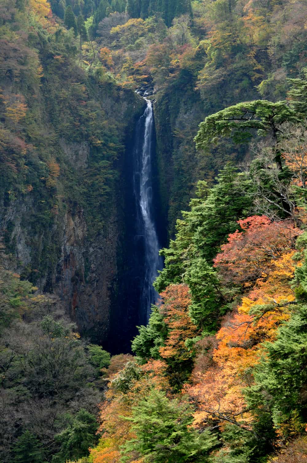
A fair question about any paid bridge: what exactly are you paying to look at? The answer is that the bridge is the viewing platform, and the gorge it crosses is the attraction.
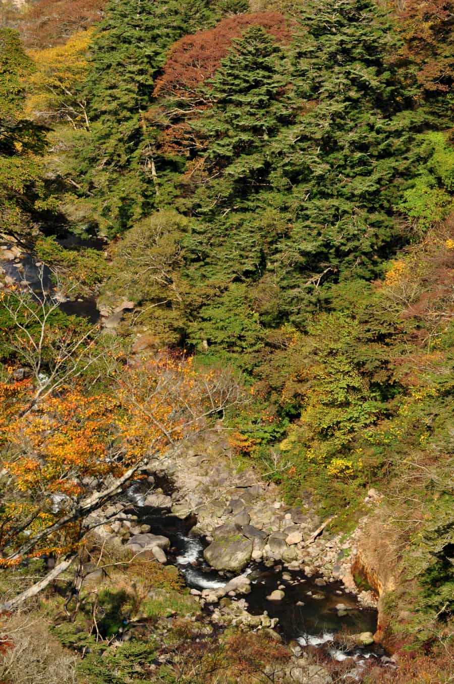
Below runs the Naruko River gorge, and upstream lies Kyusuikei, the hairpin-bend valley known for its autumn colour. Facing you from the deck is Shindo Falls, which splits into a male fall (Odaki) and a female fall (Medaki); the male fall is listed among Japan's "100 Notable Waterfalls." That viewing angle is the real value proposition here. Waterfalls in Japan are almost always experienced by craning your neck upward from a valley floor. Here you stand 173 metres up, roughly level with the cascade, with the full depth of the gorge running away beneath you. Seeing a major waterfall at eye level from mid-air is genuinely rare in Japan, and it is the main reason I think the ticket is well spent.
Distance-wise: 390 metres each way is 780 metres round trip. Walking it while photographing, then pausing on the far side to take in the falls, works out at roughly 20 to 40 minutes for most people — an estimate from the walking distance, not an official recommendation. Add the observation plazas and a stop for souvenirs and the entire attraction is done inside an hour. That short dwell time is not a criticism, but it is the fact that drives the verdict at the end of this guide.
Which entrance: Nakamura vs Kitagata
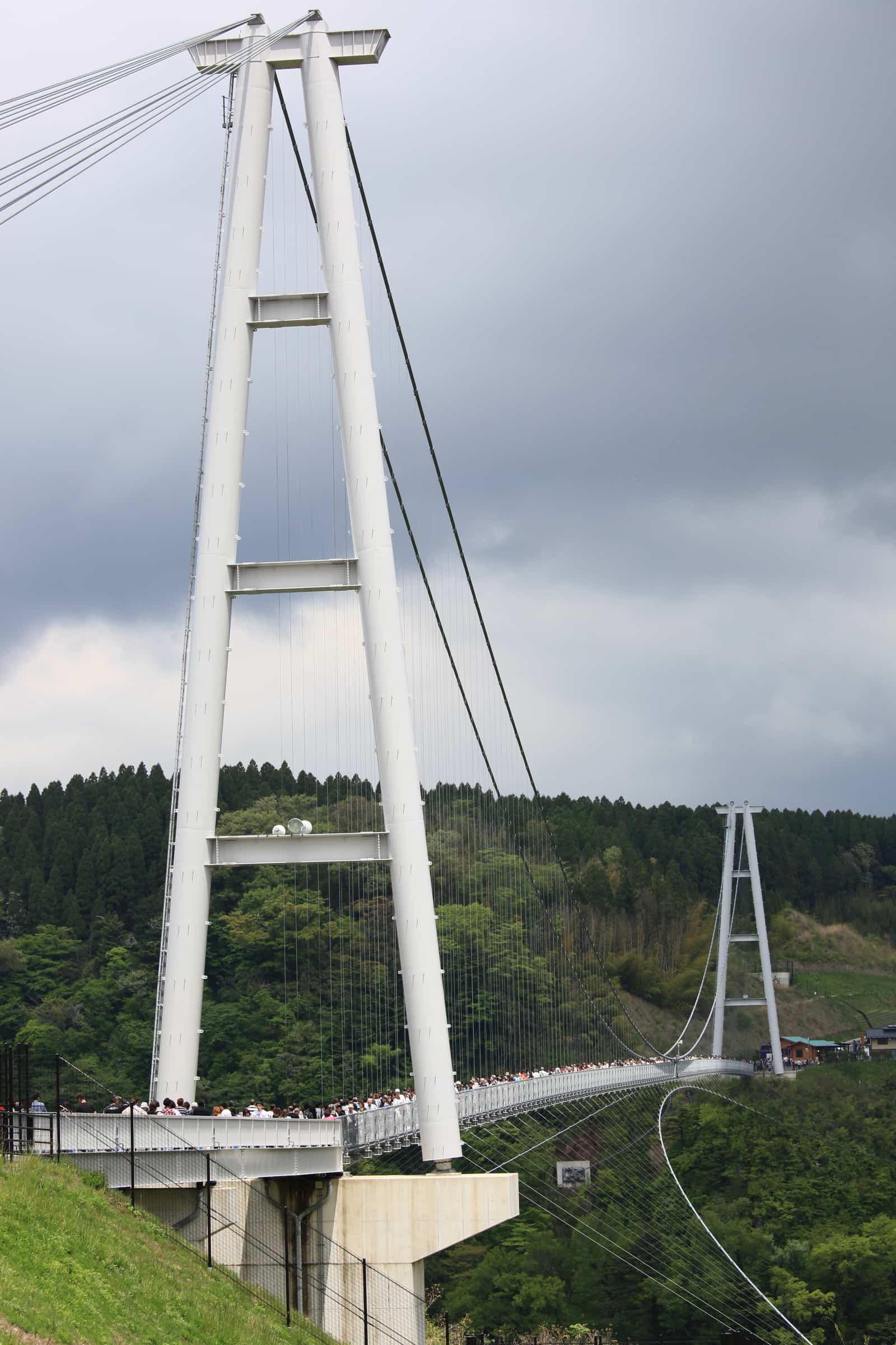
The bridge has an entrance at each end, and first-time visitors rarely know the difference. It comes down to parking capacity and what is next to it:
| Item | Nakamura side | Kitagata side |
|---|---|---|
| Standard car spaces | about 229 | about 46 |
| Coach spaces | about 37 | not listed officially |
| Facilities | Observation plaza (repaved in 2024) | Tenkukan, a JA farm-produce shop |
| Best for | Drivers, coach groups, peak season | Souvenirs and a quick bite |
| Parking fee | The official page lists space counts only and does not state a fee — confirm on site | |
The practical conclusion is straightforward: if you are driving, and especially in foliage season, head for the Nakamura side. With 229 standard spaces plus coach bays it holds roughly five times what the Kitagata side does, and on a busy November weekend that difference decides whether you park or circle.
The Kitagata side has its own draw, though. Tenkukan, run by the JA Oita Seibu agricultural cooperative, is a farm-produce shop selling local souvenirs and processed goods, with local-style burgers and light takeaway food on the other side of the operation (per local dining-platform listings; items and serving days vary, so treat it as on-the-day information). If you arrive by bus, or do not mind tight parking, entering from Kitagata lets you knock out souvenir shopping on the same walk. As for shops on the Nakamura side, this guide did not verify individual names and trading status, so it will not list any.
One deliberate omission: the official page does not state whether parking is free, only how many spaces exist. Plenty of third-party pages describe it as free parking, but with no primary source confirming that, this guide says "check the signage on site" rather than putting a number — or a promise — in your head.
Access: community bus, Nishitetsu package, driving
Kokonoe Town sits deep in inland Oita, and access is the honest constraint on this attraction. Three approaches, split by traveller type:
1. Driving (the most flexible)
The route given by the operator and local tourism bodies is the Kyushu Expressway to the Kokonoe IC, then Prefectural Route 40 straight to the bridge. Reckon on about 2 hours 30 minutes from the Fukuoka direction, and about the same from the Kumamoto direction; Beppu and Yufuin are far closer and make natural same-day pairings. The stretch from Kokonoe IC is classic mountain prefectural road — plenty of curves, and ice is possible in winter — so do not estimate the drive at lowland speeds.
2. Rail plus community bus (the car-free baseline)
Take the JR Kyudai Main Line to Bungo-Nakamura Station, a limited-express stop, then transfer to the Kokonoe Town community bus, Kokonoe Judan line. The official access page is explicit about fares:
- Flat single fare across the whole line: 500 yen for adults, 250 yen for elementary students, free for preschoolers (half price for visitors with a disability)
- Route: Kokonoe IC – Bungo-Nakamura Station – Kyusuikei – Otsurihashi (the bridge) – Iida Community Centre – Sujiyu – Kokonoe Trailhead – Makinoto Pass
- Operation: daily; the Makinoto Pass to Kokonoe Trailhead section suspends from December 1 to the end of February; January 1–3 runs on the Sunday/holiday timetable
The blunt part: services on this line are infrequent, and the timetable is what makes or breaks the day. The official page notes the timetable was revised back in March 2021, so treat the current Kokonoe Town notice as authoritative, check it before you travel, or call the town office's Future Design Promotion Division on 0973-76-3874. No official journey time in minutes was verified for this guide, so none is quoted here — but the operational advice is unchanged: nail down the return departure before you cross the bridge, not after. The same line links Sujiyu Onsen and the Kokonoe trailhead, so if you want to combine the bridge with hiking in the Kuju range, this bus is the spine of that plan.
From the Yufuin direction there is also a Kamenoi Bus service to the bridge, but per secondary sources it runs on weekends and public holidays only, twice a day in each direction — do not build a weekday plan on it. Note too that the Kyushu Odan Bus (from Kumamoto, Beppu or Yufuin) does not reach the bridge directly; it stops at the Kokonoe Trailhead, from where you still need the town community bus. That misunderstanding wrecks more itineraries here than anything else.
3. From Fukuoka: the Nishitetsu package (easiest without a car)
If you are based in Fukuoka with no car and want the bridge in a single day, the cleanest answer is Nishi-Nippon Railroad's three-in-one ticket:
| Item | Detail |
|---|---|
| Ticket | Kokonoe Yume Otsurihashi Kippu (Nishitetsu) |
| Price | 7,600 yen (adult, junior-high age and up; normally 10,000 yen, around 24% off) |
| Includes | Round-trip highway bus Fukuoka (Tenjin BT / Hakata BT / Fukuoka Airport International) ⇄ Yufuin, round-trip local bus Yufuin ⇄ the bridge, plus bridge admission |
| Valid | April 4 (Sat) to November 29 (Sun), 2026; valid 10 days from the outbound travel date |
| How to buy | Reserve by phone with the Kyushu Highway Bus Reservation Centre on 092-734-2727, then collect at Nishitetsu Tenjin Highway Bus Terminal, Hakata Bus Terminal or Fukuoka Airport Bus Terminal |
The saving is real (10,000 yen down to 7,600), but the bigger win is that it bundles the two awkward legs — Fukuoka to Yufuin, then Yufuin to the bridge — and throws in admission so you skip the ticket queue on arrival. Validity runs to November 29, which covers the entire 2026 autumn season. Details and current availability are on the official Nishitetsu page: nishitetsu.jp (not an affiliate link, just the useful one).
Two constraints to know before you build a day around it. First, it requires a phone reservation — you cannot simply turn up and buy. Second, the Yufuin-to-bridge local bus runs on weekends and public holidays only, so this is fundamentally a weekend product. If your dates fall midweek and you are not renting a car, you are back to the Bungo-Nakamura-plus-community-bus route, or a charter.
For completeness: if what you actually want is a day out from Fukuoka toward Yufuin and you are not wedded to the bridge itself, Trip.com sells a Yufuin-no-Mori scenic train, Yufuin and Dazaifu day trip from Fukuoka. To be clear, that tour does not include the Kokonoe Yume Bridge — it answers a different question, so do not confuse the two. For the bridge specifically, the Nishitetsu ticket is the direct route. One last practical note: mountain Kokonoe has long tunnels and patchy reception, and checking bus times or weather notices all needs data, so having an unlimited eSIM live the moment you land saves a lot of grief — a KKday Japan eSIM is the usual pick, and the Japan eSIM guide compares the five main options.
How it got built: a 1956 idea and a 2-billion-yen gamble
This is the most underrated part of the Kokonoe Yume Otsurihashi. It was not built by a tourism conglomerate — it was borrowed for and built by a town of under twenty thousand people. The following is compiled from local historical records and official history summaries rather than first-hand verification:
- 1956: a local merchant, Tokimatsu Tsugumatsu, floated the idea that a bridge across this gorge would let people see the waterfalls and the autumn colour at the same time. It was not taken up.
- 1993: the idea was formally written into Kokonoe Town's tourism plan — nearly four decades after it was first proposed. The "Yume" (dream) in the bridge's name refers to exactly that long-deferred local ambition.
- May 2004: main construction began, running about two and a half years.
- October 30, 2006: the bridge opened at noon, with the completion ceremony held the same day.
The finances are the striking part. The total project cost was around 2 billion yen including surrounding works, and it was funded with no national or prefectural subsidy — the town carried it. Of that, 730 million yen came from regional revitalisation bonds, and the town cleared them just two years after opening, eight years ahead of the repayment schedule.
Why so fast? Because visitor numbers blew past the forecast. The town had projected roughly 300,000 visitors a year before opening. What actually happened:
| Milestone | Date reached | Time since opening |
|---|---|---|
| 1 million cumulative visitors | April 10, 2007 | about 5.5 months |
| 5 million cumulative visitors | October 15, 2009 | about 3 years |
| 10 million cumulative visitors | March 1, 2017 | about 10 years 4 months |
A million people in under six months is more than three times the projected annual figure, achieved in half a year. As case studies in Japanese regional tourism development go, that is an outlier: an unsubsidised, bond-financed municipal facility that repaid its debt in two years and passed ten million visitors in ten. (No milestone beyond the 2017 ten-million mark was verified for this guide, so no current cumulative total is quoted.)
Knowing that changes the walk slightly. The "dream" in the name is not marketing copy — it is a record of a 1956 suggestion that took fifty years to become a structure you can stand on.
Planning autumn: peak timing, crowds, timing traps
The bridge is open year-round, but autumn is what makes people travel for it. Per Oita prefectural tourism media describing typical years, peak foliage around Kyusuikei and Shindo Falls falls roughly from late October to mid-November, with zelkova, katsura and other species colouring the whole valley — from the deck it reads as an unbroken canopy of red and gold with a waterfall cut into it. Treat that as a typical-year window rather than a confirmed date for any particular year: current-season forecasts generally only appear from September or October, so re-check about two weeks before you travel.
On crowds, early November is the peak. During that stretch the 46 spaces on the Kitagata side are effectively out of the question, and even the Nakamura car park queues. Visitor discussion commonly recommends going on a weekday or arriving right at the 8:30 opening — sensible advice, but common sense rather than published off-peak data, so it is presented as such and not dressed up as an official recommendation.
The thing genuinely worth memorising, though, remains the hours trap. Peak colour spans both October and November, and those two months differ by a full hour of opening. In October: closes 18:00, tickets to 17:30. In November: closes 17:00, last entry 16:30. A November afternoon that starts in Beppu or Yufuin and picks up a stop or two on the way very easily reaches the gate at 16:40 — too late. Build a November itinerary that puts you at the bridge by 15:30 and the problem disappears.
To compare peak timing and routes across the rest of the region, see the Kyushu autumn foliage guide. For a two-day inland Oita autumn loop, pair the bridge with the rock formations and gorge colour covered in the Yabakei guide.
Worth a special trip? An honest verdict
So — is the Kokonoe Yume Bridge worth it?
Honestly: it is an excellent stop to fold into a route, and a poor choice as a destination in its own right. The reasoning is simple arithmetic. The attraction is done in under an hour — 20 to 40 minutes for the crossing, another twenty for the observation plazas and the produce shop, and then there is nothing else to do. Meanwhile it sits deep in inland Oita, five hours of driving round trip from Fukuoka. Trading five hours of transport for one hour of experience does not add up, however good that hour is.
Broken down by traveller:
- Anyone on the Yufuin or Beppu circuit: strongly recommended, just put it in. If you are already staying in either hot-spring town, the bridge is a comfortable half-day return and the prefectural road delivers the Kyusuikei scenery on the way. For where to stay and soak, see the Yufuin onsen guide and the Beppu onsen guide.
- Anyone driving inland Kyushu: worth it, especially in autumn. The Aso–Kuju–Yufuin loop is a driving itinerary anyway, and the bridge is one of very few points on it where you park, walk half an hour, and get a genuinely big view. The effort-to-payoff ratio is excellent.
- Day-tripping from Fukuoka with no car: exactly one sensible answer. The Nishitetsu Kokonoe Yume Otsurihashi Kippu at 7,600 yen, which bundles transport, transfers and admission — and is weekend-only. If your dates are midweek and you are not renting a car, my straight advice is to skip it this trip and spend the day somewhere better connected. Come back when you have wheels or a weekend.
- Anyone with serious vertigo: weigh it first. The grating section is a real 173-metre look straight down and not everyone gets through it comfortably. If that is you, the Nakamura observation plaza gives you the gorge without the crossing, and nobody is obliged to walk the full span.
To be completely fair to the place: the experience itself does stay with you — a "100 Notable Waterfalls" cascade seen at eye level from mid-air, 173 metres of gorge beneath the mesh, and behind it the story of a small town that spent 2 billion yen of its own borrowed money and paid it back in two years. At 500 yen, I think the ticket is very good value. The limitation is not the bridge, it is the combination of a short visit and a remote location. Understand that and you will know exactly where it belongs in a plan: as a one-hour highlight on an inland Oita route, not as the headline act of a day.
Frequently Asked Questions
- Q1:How much is admission to the Kokonoe Yume Otsurihashi?
- The current official rate is 500 yen for junior-high age and up, 200 yen for elementary-school children, and free for preschoolers. Visitors with a disability plus one companion pay half price, and groups of 30 or more get 10 percent off the base rate. These rates apply through all of 2026, including the October-November foliage peak — there is no peak-season surcharge here. Kokonoe Town has published a revised fee structure taking effect on January 1, 2027, but its content is new discounts for town residents, school excursions and similar groups; ordinary visitors are not affected, so a 2026 autumn trip pays exactly these rates.
- Q2:How long does it take to walk the Kokonoe Yume Bridge?
- The operator does not publish a suggested visit length, so work it out from the span: the bridge is 390 metres long, making a round trip 780 metres. Allowing for stopping to photograph the waterfalls and pausing at the far-side viewpoint, most visitors take roughly 20 to 40 minutes to walk it both ways. That is an estimate derived from the walking distance, not an official figure. Add the observation plazas and the produce shop at either end and the whole attraction is comfortably done inside an hour — which is exactly why this guide treats it as a stop to fold into a route rather than a half-day destination.
- Q3:Can you cross it if you have a fear of heights?
- Go in with your eyes open. The deck sits 173 metres above the water, making this the highest pedestrian suspension bridge in Japan, and a section in the middle of the deck uses open grating, so you look straight down through your feet to the gorge floor. The operator has issued no formal vertigo warning — that grating is simply a design fact, not an official advisory. Practical advice: walk along the solid strips near the railings, keep your eyes on the waterfall ahead rather than on your shoes, avoid windy days when the deck movement amplifies the nerves, and hold onto children at the grating section, which is exactly where they want to crouch down and look through. If heights are genuinely impossible for you, the observation plaza on the Nakamura side still gives you gorge views without crossing.
- Q4:Does the bridge close in bad weather?
- It can. The official site states plainly that entry may be restricted in bad weather, and lists the specific conditions: sustained winds of 15 metres per second or more, dense fog, a heavy-rain or flood advisory or above, a heavy-snow advisory, and earthquakes of seismic intensity 4 or higher. There is no fixed weekly closing day — the official listing says none — but that is not a guarantee it will be open on your date. Fog matters as much as closure here: on a foggy morning in this highland area you may pay, cross, and see nothing but white. Check the forecast on the day, or call the management centre on 0973-73-3800. As of the July 2026 verification, the official notice page carried no 2026 construction, road-closure or temporary-closure announcements at all.
- Q5:How do you get to the Kokonoe Yume Bridge without a car?
- Two realistic options. The first is rail plus community bus: take the JR Kyudai Main Line to Bungo-Nakamura Station, where limited express trains stop, then transfer to the Kokonoe Town community bus on the Kokonoe Judan line. The official access page gives a flat single fare of 500 yen for adults, 250 yen for elementary students and free for preschoolers, but services are infrequent, so check the current Kokonoe Town timetable before you travel or call 0973-76-3874. The second, and the easiest option from Fukuoka, is the Nishitetsu Kokonoe Yume Otsurihashi Kippu: 7,600 yen covering the round-trip highway bus between Fukuoka and Yufuin, the round-trip local bus between Yufuin and the bridge, and bridge admission. It is valid April 4 to November 29, 2026, requires a phone reservation on 092-734-2727, and note that the Yufuin-to-bridge leg runs on weekends and public holidays only.
- Q6:Is the Kokonoe Yume Bridge the longest suspension bridge in Japan?
- No, and this is where a lot of older articles are now wrong. Its main span is 390 metres, but the Mishima Skywalk opened in 2015 at 400 metres and GODA BRIDGE in Osaka opened in March 2025 at 420 metres, so Kokonoe now ranks roughly third by length. What it still holds is the height record: at 173 metres above the water it remains the highest pedestrian suspension bridge in Japan, and the operator itself only claims the height title, not the length one. If you see a page calling it Japan's longest, you are reading pre-2025 information.
- Q7:When is the best time for autumn colour at the bridge?
- According to Oita prefectural tourism media reporting typical years, the peak around Kyusuikei gorge and Shindo Falls falls roughly from late October to mid-November, with early November the busiest stretch. There is a scheduling trap buried in that range: in October the bridge runs 8:30 to 18:00 with ticket sales until 17:30, but from November 1 it reverts to 8:30 to 17:00 with last tickets at 16:30. If you are chasing colour in November, plan to arrive before about 15:30 rather than assuming an October-style late afternoon. To dodge the crowds, visitor discussion commonly suggests weekdays or arriving right at the 8:30 opening — that is common-sense advice rather than an official off-peak recommendation.
Read next
Kyushu Autumn 2026: Mifuneyama, Unzen & Yabakei Guide
Mifuneyama 2026 illumination dates are out — Kyushu foliage is scattered, so here is the drive-vs-rail verdict.
Yufuin Onsen Guide 2027: Lake Kinrin, Yunotsubo & Yufuin no Mori
Kyushu's most popular onsen town — Lake Kinrin's dawn mist below Mt. Yufu, Yunotsubo Street and the Yufuin no Mori train.
Yabakei Guide: Aonodomon Reopening & Free Gorge Views
Aonodomon reopened to walkers in April 2026 but stays closed to cars — an honest guide to Yabakei’s all-free gorges, the 27-minute bus, and the weekend bus gap.
📊 See the 2026 Price Index (JR Pass, DPA, eSIM, Airport Transport) →