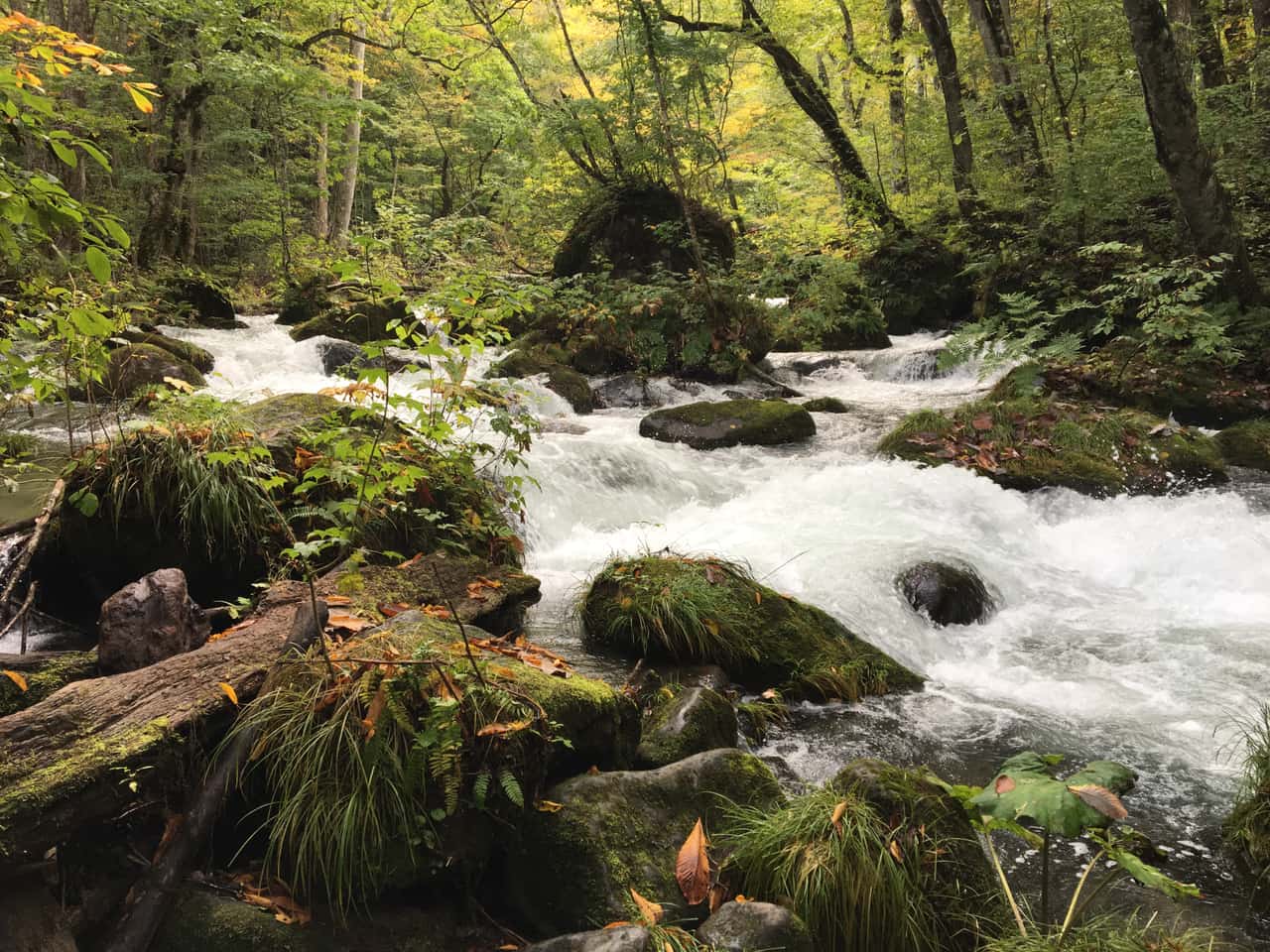
Lake Towada, Oirase Gorge and Hachimantai are three names that actually belong to one park — Towada-Hachimantai National Park — spread across Aomori, Akita and Iwate, the wildest, most expansive corner of northern Honshu. Two numbers worth fixing up front: the Oirase trail runs a full 14 km from Nenokuchi to Yakeyama, past dozens of waterfalls and rapids, a perennial on Japan's "Top 100 foliage spots" list; and Hachimantai's "Dragon Eye" only possibly opens for the two-to-three weeks from late May into early June. But here is the blunt thing to know first: there is no train along the Oirase stream and no railway up Hachimantai — the whole region runs on JR buses or a rental car. That single fact trips up most Tohoku plans. Below: each area's highlights, the best seasons, and how to actually stitch the transport together. To fold it into a bigger Tohoku trip, north is Aomori, south chains to Sendai.
- All three sit in Towada-Hachimantai National Park, across Aomori/Akita/Iwate — nature-first, with few towns
- Oirase Gorge's 14 km trail: do the best stretch, Ashura-no-Nagare to Choshi Otaki; foliage peaks late October
- Lake Towada is a double-caldera lake: boat links Nenokuchi↔Yasumiya, where Takamura Kotaro's Maiden Statue stands
- The Aspite Line opens around mid-April (April 15 in 2026), snow corridor up to 7 m high
- Dragon Eye (Kagami-numa) is a late-May to early-June gamble — check the official "opening status"
- No train at Oirase: JR's Mizuumi / Oirase buses or a rental car; self-driving is smoothest
📖 Contents
Three areas, one national park
Plenty of people research Lake Towada, Oirase and Hachimantai as three separate sights and end up with a tangled transport plan. Fix the mental map first: they share one "Towada-Hachimantai National Park," but that park is really two unconnected mountain blocks — the northern Towada-Hakkoda area (Lake Towada + Oirase + Mt. Hakkoda) and the southern Hachimantai area. Mountains sit between them, and no single, convenient public-transport line links the two. That is exactly why, honestly, without a car you cannot smoothly do all three in a single day.
So what does this trip actually sell? Undeveloped northern-Japan wilderness: Oirase is stream and waterfall, Lake Towada is the deep blue of a crater lake, Hachimantai is high-alpine marsh and snowmelt spectacle. There is almost no city sightseeing and no dense checklist of stops — the pace is slow and the crowds are thin (peak-foliage Oirase excepted), which suits travelers who want out of the city and into nature. If you want shopping and back-to-back attractions, this is not it; but if you would travel for a 14 km stream, or a "dragon's eye" that opens for two weeks, this stretch of Tohoku rewards you.
One more framing point that saves a lot of regret: do not try to "tick all three" on a tight schedule. The northern block (Lake Towada and Oirase) and the southern block (Hachimantai) are genuinely far apart by road, and their peak seasons barely overlap — Oirase is an autumn act, the Dragon Eye a late-spring one. Most travelers are better off treating this as either an autumn-foliage trip or a spring-snow trip, building two relaxed days around one block rather than a frantic dash across both. The rest of this guide is structured that way.
Oirase Gorge: the 14 km falls trail
Of the three, Oirase Gorge is my number one. It is the only river flowing out of Lake Towada, running about 14 km from lakeside Nenokuchi to Yakeyama, designated a Special Place of Scenic Beauty and a Natural Monument, and a regular on Japan's "Top 100 foliage spots." Unlike the usual "view a waterfall from afar" sight, the trail runs almost level with the stream and road the whole way, past dozens of rapids and falls one after another — you walk inside the gorge rather than gaze at it, which is its real magic.
The terrain brings good news and bad. The good: the stream is almost flat and the trail is easy — no mountaineering gear, just a stroll. The bad: all 14 km is 5–6 hours, too long for most travelers, and there is only a local bus along the stream, no train, so when you tire you cannot just hop a train back. The smart play is "walk the best stretch, bus the rest," covered next. Signature scenes along the way include Ashura-no-Nagare (the rapids you see most on posters and in magazines — muscular water hemmed by dense forest) and Choshi Otaki below.
Choshi Otaki & the best stretch to walk
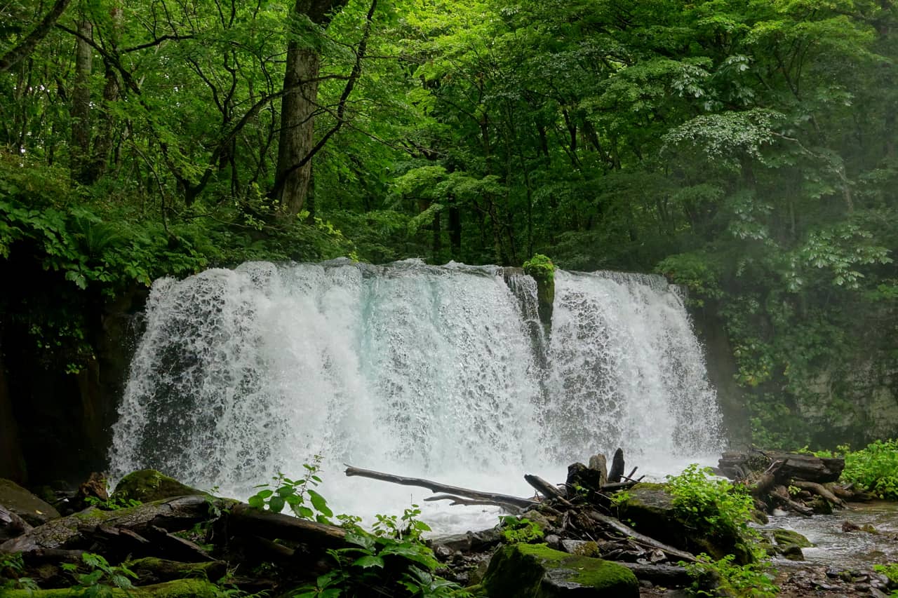
Choshi Otaki is the only — and largest — waterfall on the main Oirase stream: about 7 m high and 20 m wide, heavy with water and loud with it. Its nickname is "Uodome-no-Taki," the fish-stopping falls, because the drop blocks fish from migrating up to Lake Towada, making it a natural boundary of the gorge. The spray throws light beams when sun slips through the canopy, and paired with the red maples on both banks in autumn it is Oirase's most classic frame.
For anyone short on time who still wants the highlights, here is my concrete call: walk the "Ishigedo → Ashura-no-Nagare → Kumoi-no-Taki → Choshi Otaki" stretch, roughly 3–4 km, budgeting about 2 hours with photo stops — nine-tenths of Oirase's famous scenes are in that span. Two ways to route it: (1) walk upstream (from lower Ishigedo up to Choshi Otaki, then catch the boat across Lake Towada from Nenokuchi to Yasumiya); or (2) walk downstream (start at Nenokuchi, walk the best stretch down, bus back). Both work; the difference is whether you front-load the boat ride. The key is that the bus is infrequent — lock in your return time so you do not finish mid-trail and find the next bus is an hour off.
A few honest practicalities for the walk. The path is unpaved in places and runs close to the water, so it can be muddy and slick after rain — wear shoes with grip rather than sandals. There is little shade-free open sky, which is a blessing in summer heat but means it gets dim early in autumn, so start the best stretch in the morning. Cafes and toilets are sparse along the trail, clustered mainly around Ishigedo, Nenokuchi and Yakeyama, so use them when you see them. And because the road and trail run side by side, you can bail out to a bus stop at almost any point if the weather turns or the kids run out of steam — one more reason the "walk a segment, bus the rest" approach beats a forced march to the end.
Lake Towada & the Maiden Statue
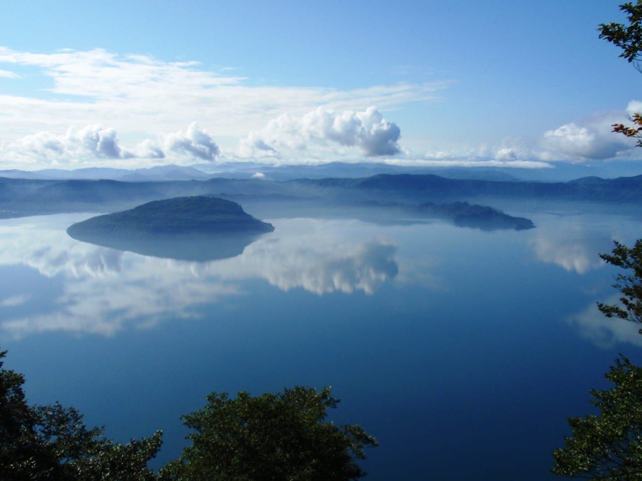
Oirase's source is Lake Towada — a double-caldera lake formed by volcanic activity roughly 200,000 years ago (it even holds an inner "Naka-umi" lake, the structure of a double caldera), and at 327 m one of Japan's deepest. The water shifts from deep blue to dark green with the light, and the lookouts around it (Ohanabe-yama, Hakka-toge) give the grandest views. Yasumiya on the shore is the area's hub, where the hotels, restaurants and the cruise pier sit.
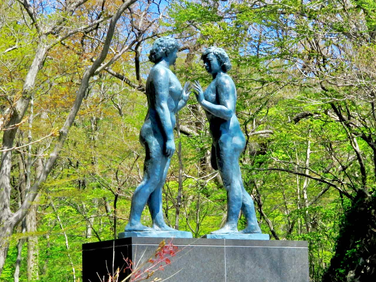
The best-known landmark on the Yasumiya shore is the Maiden Statue — two bronze figures facing each other, made by poet-sculptor Takamura Kotaro in 1953 to mark Lake Towada's designation as a national park, his last major work before his death, and the lake's emblematic image. The loop is simple: the cruise boat links Nenokuchi on the Oirase side with Yasumiya, so you can walk the best stretch of Oirase, board at Nenokuchi, cross the lake, and land at Yasumiya for the Maiden Statue — stream, lake and statue on one line. The boat is seasonal (closed in winter), with schedules and the A/B routes shifting by season, so check the official timetable before you go.
Hachimantai: snow corridor & Dragon Eye
Cross the mountains to the southern Hachimantai area and the scenery changes completely — this is high-alpine marsh and volcanic terrain straddling Akita and Iwate, the summit dotted with ponds and boardwalks over wetland, alpine plants in summer and grass-foliage in autumn. But what made it go viral lately is two season-limited spectacles.
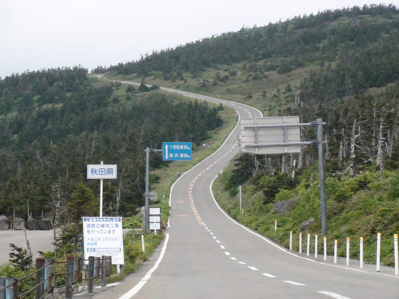
The first is the snow corridor. The mountain road up — the Hachimantai Aspite Line (Prefectural Road Ofuke-Hachimantai) — is closed in winter and opens fully around mid-April each year (April 15 in 2026). Right after opening, thick leftover snow still walls both sides, plowed into a several-meter "snow corridor" — up to about 7 m at its highest — where you drive between snow walls, the road's once-a-year signature, lasting roughly into early May.
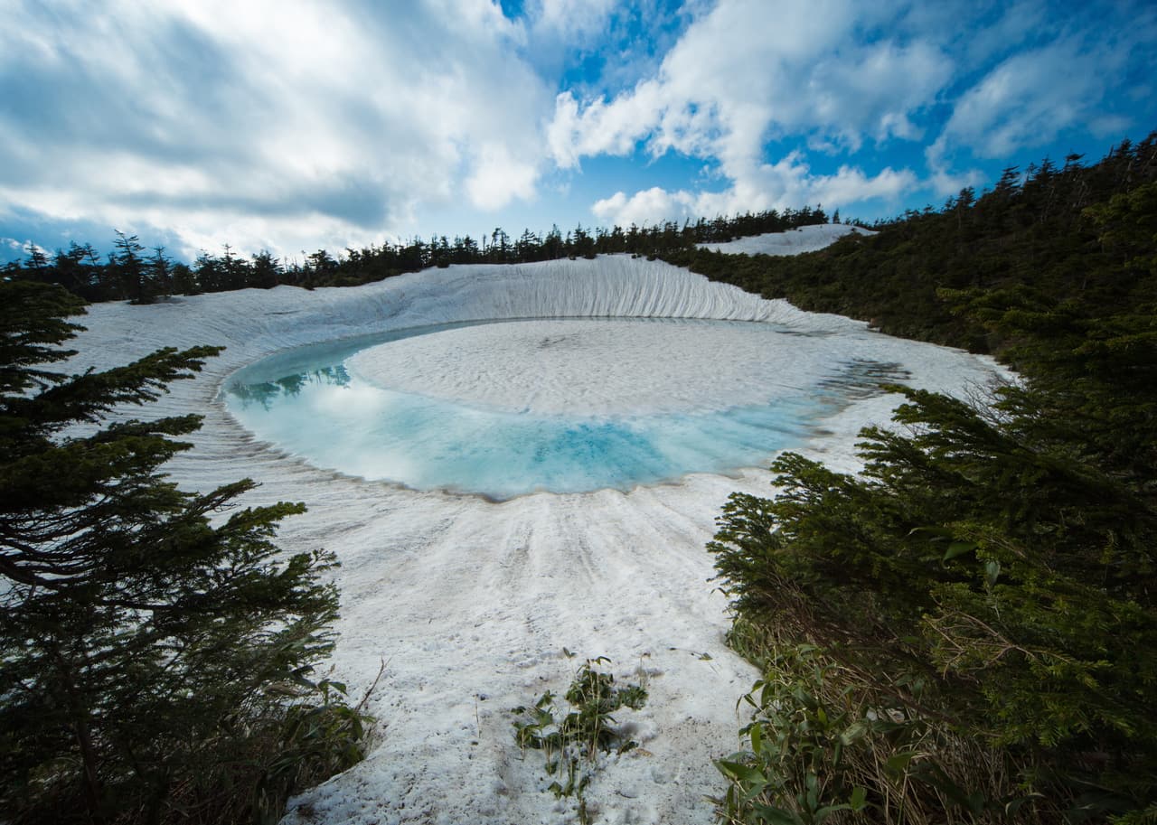
The second, and the bigger draw lately, is the Dragon Eye. It refers to the snowmelt spectacle at Kagami-numa pond near the Hachimantai summit: as the snow in the pond melts, the rim of melting ice forms a blue-green ring with a snow mound rising at the center, looking from above like an opening dragon's eye. It is at its best from late May into early June, but whether you catch the full "opening" depends on that year's snow depth, temperature and weather lining up — it is a gamble, not a sure thing just because you showed up. Track the official and visitor-center "opening status" updates before you go so you do not strike out. Reaching Kagami-numa requires the Aspite Line to be open, so the Dragon Eye season slots right after the snow corridor — a late-spring, early-summer Tohoku exclusive.
Best season: foliage vs. spring snow
This region is strongly seasonal, and different months show you two completely different landscapes — decide which you are here for:
- Autumn (late October) — Oirase / Lake Towada foliage: the season most people travel for. Oirase peaks around Oct 20–31 (starting to turn mid-October), coloring from upstream down, with stream and falls against red maples at "Top 100" level. The downside: it is crowded, with traffic jams on foliage weekends, and the 2026 private-car restriction runs 7–13 September, not in October as in previous years.
- Late spring to early summer (mid-April to early June) — Hachimantai snow corridor & Dragon Eye: the Aspite Line opens mid-April for the snow corridor (up to 7 m), and the Dragon Eye is a late-May to early-June gamble. Oirase is still new green and Lake Towada's leftover snow is just melting — a fresher, cleaner scene.
- Summer (July–August): Oirase's shade is at its coolest and Hachimantai's alpine plants are in bloom — good for a cool-weather hike, with fewer people than the foliage season.
- Winter: the Aspite Line is closed, the upper mountain is shut, and the cruise stops — unless you are specifically here for snow or skiing, it is not the area's peak.
So the bottom line is blunt: first-timers chasing the signature foliage should lock late October for Oirase + Lake Towada; for the snow corridor or Dragon Eye, lock mid-April to early June for Hachimantai. Those two peaks do not overlap, and cramming both into one trip is hard — pick one to headline. For all-season packing, see our Japan packing & weather guide — the altitude here swings cold between day and night, so even on a summer evening, bring a light jacket.
Transport & lodging (bus vs. car)
This is the most important section for planning the trip, so read it through. First, the key fact: there is no train along the Oirase stream and no railway up Hachimantai — the whole region runs on bus or self-driving. And the two mountain blocks fall under different transport systems:
- Lake Towada + Oirase (north): two seasonal JR Bus Tohoku lines — the "Mizuumi" from Aomori / Shin-Aomori via Hakkoda to Oirase and Lake Towada, and the "Oirase" from Hachinohe to Oirase and Lake Towada. Both run roughly spring to autumn, take 2+ hours, and are infrequent, so check the timetable. Hopping the best stretch of Oirase relies on this same bus system.
- Hachimantai (south): a separate system, usually reached from the Morioka or Lake Tazawa side (Hachimantai's own shuttle buses plus self-driving), on a different, unconnected route from Towada/Oirase. Without a car it is hard to combine the two blocks in one day.
- Rental car: honestly, if you want all three smoothly plus the snow corridor or Dragon Eye (which essentially have no direct bus), a rental car is the only practical option. Pick up in Aomori, Hachinohe or Morioka; every sight has parking, and the flexibility easily beats waiting on buses.
If the wider Tohoku trip leans heavily on JR (Shinkansen in and out plus regional hops), run the break-even math in our JR Pass guide on a JR East-type pass first — but note the Oirase JR buses and the Hachimantai mountain buses may not all be covered, so confirm those legs separately. For lodging: for Towada/Oirase, stay at an onsen ryokan along the Oirase stream or on the Lake Towada shore (Yasumiya) — quietest after the day-trippers leave, and straight onto the trail in the morning; for Hachimantai, stay in the Hachimantai hot-spring district or Morioka. Peaks here (foliage weekends, Dragon Eye season, Golden Week) get tight, so book early.
Search the two mountain blocks separately. All of the lists below open on today's date, not foliage or Dragon Eye season, so change the dates first:
| Where you want to stay | Where to look | Watch out for |
|---|---|---|
| Along the Oirase stream or on the Lake Towada shore (Towada City, Aomori) | stays near Yakeyama on Booking.com (the lower end of the trail), Towada City on Rakuten Travel, Towada on Agoda | Rakuten Travel and Agoda cover the whole city, including business hotels in central Towada that are nowhere near the stream — check the location before you book. |
| Hachimantai hot-spring district (Hachimantai City, Iwate) | Hachimantai on Booking.com, Hachimantai City on Rakuten Travel, Hachimantai on Agoda | All three cover the whole city, and many of the first results are resort hotels around the Appi Kogen ski area, which is not on the Aspite Line — check the location before you book. |
Suggested routes
Two main lines, depending on your season and whether you drive:
- Autumn · foliage line (2 days, car or JR bus): Day 1, take the JR bus (or drive) from Aomori/Hachinohe into Oirase, walk the "Ishigedo → Ashura-no-Nagare → Choshi Otaki" stretch → board the cruise at Nenokuchi across Lake Towada to Yasumiya → see the Maiden Statue → stay at a lakeside onsen ryokan. Day 2, take in Lake Towada from the lookouts (Ohanabe, Hakka-toge) → add another Oirase segment if your legs hold → back to Aomori/Hachinohe.
- Late spring · Hachimantai line (2 days, car recommended): Day 1, pick up in Morioka and drive the Hachimantai Aspite Line for the snow corridor (mid-April to early May) → walk the summit marsh boardwalks → if it is late May to early June, go for the Kagami-numa Dragon Eye (check opening status first) → stay in the Hachimantai hot-spring district. Day 2, extend to Lake Tazawa or Kakunodate as time allows → back to Morioka.
To fold this wilderness into a fuller Tohoku loop, the northern gateway is Aomori (Hakkoda, seafood — see our Aomori travel guide; if your dates land in early August, the schedule, seats and haneto rules are in the Aomori Nebuta Festival guide), and you can run south all the way to Sendai (Matsushima, gyutan — see our Sendai travel guide) for a 5–7 day deep dive. For pass evaluation across JR legs and routing the whole thing, read it alongside our JR Pass guide.
FAQ
- Q1:Do you have to walk the whole Oirase Gorge? What if you can't finish it?
- No — and most people neither do nor should. The Oirase trail runs about 14 km from Nenokuchi (on Lake Towada) to Yakeyama, which is 5–6 hours of slow walking and photo stops, too much for the average traveler. My advice is to do the best stretch: walk the most scenic falls-and-rapids section from Ashura-no-Nagare to Choshi Otaki (roughly 3–4 km, budget 2 hours) and hop the rest on the JR buses that shadow the road. The terrain is almost flat and easy, but there is no train along the stream, so you rely on the bus to skip sections — check the timetable first. For the full reverse-walk approach and foliage detail, see the Oirase section in our Aomori travel guide.
- Q2:When is Oirase Gorge's autumn foliage at its best?
- Per official sources and visitor reports, Oirase's color peaks in late October (roughly Oct 20–31), starting to turn in mid-October. The signature is that it colors from the upstream end (Nenokuchi, higher elevation) downward — come early and the upper stream is already a golden tunnel while the lower stream is still green; come later and the whole gorge is red. To dodge the crowds, go on a weekday at first light — Oirase clogs with traffic on foliage weekends, But the 2026 private-car restriction does not fall in foliage season at all — it runs 7–13 September, more than a month earlier than 2024 (Oct 21–27) or 2025 (Oct 27–Nov 2), and 13 September is the first full closure to every vehicle class, taxis and coaches included. Hours, affected vehicle types and shuttle fares are in our Oirase Gorge 2026 traffic restriction and bus guide. The nationwide foliage timeline is in our Japan autumn foliage guide.
- Q3:Is the Lake Towada cruise still running, and where is the Maiden Statue?
- It runs. The sightseeing boat connects Nenokuchi on the Oirase side with Yasumiya, the hub of hotels and restaurants, and it is the easiest way to take in the double-caldera lake (Lake Towada was formed by volcanic eruptions about 200,000 years ago, reaches 327 m deep, and holds an inner lake within a double caldera). The Maiden Statue stands on the lakeshore at Yasumiya — a pair of bronze figures completed in 1953 by the poet-sculptor Takamura Kotaro, a late masterwork and the symbol of Lake Towada. The cruise is seasonal (closed in winter), so check the official timetable. Chaining "walk Oirase, get off at Nenokuchi, cross the lake by boat to the Maiden Statue at Yasumiya" is the classic loop here.
- Q4:What is Hachimantai's "Dragon Eye," and when can you see it?
- The Dragon Eye is the snowmelt spectacle at Kagami-numa pond, near the Hachimantai summit: as the snow in the pond melts, the ring of melting ice turns blue-green with a snow mound floating at the center, and from above it looks like an opening dragon's eye. It is at its best from late May into early June, but "opening" the eye depends on snow depth, temperature and weather all lining up — it is not pretty every year, and there is no guarantee it will be open on the day you visit. This is a roll-the-dice natural phenomenon, so track the official and visitor-center "opening status" updates before you go. To even reach Kagami-numa, the Hachimantai Aspite Line mountain road must be open (it is closed in winter), which is why the Dragon Eye season falls right after the spring opening.
- Q5:When does the Hachimantai Aspite Line open, and can you see the snow corridor?
- Per prefectural and JR bus notices, the Aspite Line (Prefectural Road Ofuke-Hachimantai) opens fully around mid-April each year (April 15 in 2026), closed through winter. Right after opening, the road is walled by several meters of leftover snow — the "snow corridor" — the road's signature annual sight, reaching up to about 7 m and lasting roughly into early May. So: mid-to-late April for the snow corridor, late May to early June for the Dragon Eye, two back-to-back seasonal highlights. This is a high mountain road reachable only by car or sightseeing bus — there is no railway — so check the opening and road status before heading up.
- Q6:Without a car, how do you do Lake Towada, Oirase and Hachimantai?
- Honestly, public transport here is not great, and along Oirase there is bus only, no train, so go in clear-eyed about the trade-offs. Lake Towada and Oirase are served by JR Bus Tohoku's "Mizuumi" (from Aomori / Shin-Aomori) and "Oirase" (from Hachinohe) lines, seasonal (roughly spring to autumn), 2+ hours each, and infrequent — check the timetable. Hachimantai is a separate system reached from the Morioka or Lake Tazawa side, not the same route as Towada/Oirase, so it is hard to combine both in one day without a car. My advice: without a car, treat Lake Towada + Oirase as one block and give Hachimantai its own day; to do all three smoothly and catch the snow corridor or Dragon Eye, a rental car is the only practical option. If you ride a lot of Tohoku JR, run the math in our JR Pass guide.
Related reading:
Aomori Travel Guide 2027: Sannai-Maruyama, Hakkoda & Oirase
Honshu's northern tip of Jomon heritage and gateways — the World Heritage Sannai-Maruyama site, year-round nebuta floats at Wa Rasse, Hakkoda and Oirase, plus Oma tuna and apples.
Tohoku Oirase Stream 2026: 14 km Walking Trail Guide
Japan’s Top-100 foliage stream: reverse-walk strategy, Lake Towada cruise, JR East Pass math.
Sendai Travel Guide 2027: Matsushima, Aoba Castle, Zuihoden & Gyutan
Tohoku's gateway and City of Trees — Matsushima of the Three Views, Date Masamune's Aoba Castle ruins and Zuihoden, Jozenji-dori, gyutan and zunda.