The city road through Aonodomon was shut to every kind of traffic after a rock-face collapse in November 2024, and it took until 10:00 on April 1, 2026 for the pedestrian ban to be lifted across roughly a 750-metre section — while vehicles remain banned to this day, with the Nakatsu City notice last updated on June 24, 2026 still offering no timetable for reopening to cars. Almost no English-language write-up has this right, and it is the first thing you need to confirm before you plan a Yabakei day. What follows is the verified picture: four headline sights that are all free, parking included, a 27-minute direct bus from Nakatsu Station running 7 times a day on weekdays, a Shin-Yabakei connection that simply does not run on weekends, the monk who spent about 30 years cutting a tunnel through rock by hand, Japan's only eight-arch stone bridge — and the honest answer to whether Yabakei is worth a special trip if you do not have a car.
📍 Yabakei is one stop on Kyushu's autumn-foliage map — for peak-timing comparisons across the island, see the Kyushu autumn guide. To build a full inland Oita driving day, pair it with the Kokonoe Yume suspension bridge guide. For how Japan's autumn front moves nationwide, see the Japan autumn foliage guide.
- Aonodomon 2026 status (most important): walking reopened April 1, 2026 across about 750 m, with a detour through the hand-carved tunnel on the Sogi side; cars are still banned, and the city notice of June 24, 2026 gives no reopening date
- Free scenery: Aonodomon, the Hitome-Hakkei viewpoint, Yabakei Bridge, Sarutobi Senbotsukyo and every car park cost nothing — and Hitome-Hakkei is open 24 hours
- Access splits in two: Aonodomon has a direct 27-minute bus from Nakatsu Station, about 7 weekday departures, cash only; Shin-Yabakei needs a transfer at Kakisaka, 1.5 hours, and no weekend service
- Unusually strong history: a tunnel hand-cut over roughly 30 years, the setting of Kikuchi Kan's 1919 novel, and a stone bridge promoted to national Important Cultural Property in 2022
- Verdict: worth half a day to a full day if you drive; if you do not, take Aonodomon alone and skip Shin-Yabakei on weekends entirely
📖 Table of Contents (click to expand)
- Aonodomon in 2026: walk yes, drive no (read first)
- The free-scenery case: four areas compared
- Aonodomon and the monk Zenkai: 30 years and a novel
- Hitome-Hakkei: a free, 24-hour rock-pinnacle viewpoint
- Yabakei Bridge and Sarutobi Senbotsukyo
- The old railway and the cycling road
- Access, honestly: what you can and cannot reach
- Autumn and the underrated fresh-green season
- What to eat and buy: soba, Nakatsu karaage, makigaki
- Is Yabakei worth a special trip? Drivers vs the car-free
- FAQ
Aonodomon in 2026: walk yes, drive no (read first)
⚠️ The one 2026 status note that changes your plan
The Toida-Nakashima city road through Aonodomon was closed to all traffic, pedestrians included, after a rock-face collapse in November 2024. From 10:00 on Wednesday April 1, 2026 the pedestrian ban was lifted over roughly 750 metres from the National Route 212 junction to the area near Ao-no-Zenkai Bridge, with a detour through the hand-carved tunnel on the Sogi side required to get through. Vehicle traffic is still banned — fresh rockfall was found in March 2026, Nakatsu City is still assessing countermeasures, and no reopening timetable has been announced. Notice last updated June 24, 2026. This is a live case, so re-check the official pages before you go: city-nakatsu.jp and nakatsuyaba.com.
This has to come first, because it decides whether the picture in your head is achievable. Most travel write-ups about Aonodomon — including a lot of blog content still circulating — describe the pre-collapse experience: driving slowly along the Yamakuni River and through the hand-cut tunnel, with the Kyoshuho cliffs out of the window. That version is currently impossible. After the November 2024 collapse the road was shut to people and vehicles alike for more than a year, and what reopened on April 1, 2026 was walking only, and not even as a clean straight-through route: about 750 metres are open, and you use the hand-carved tunnel on the Sogi side as a detour to link it up.
In other words, Aonodomon is now a place you experience on foot. Frankly, that is not the loss it sounds like. The chisel marks, the uneven rock ceiling, the light coming through the openings cut in the wall — these are details you only register at walking pace, and driving past at 30 km/h always flattened them. What it does change is your logistics: park in the free Aonodomon public car park (about 85 standard cars and 8 large vehicles, 3.6 m height limit), then budget 40 minutes to an hour on foot to see it without rushing.
The other thing to say plainly is that this information has a shelf life. New rockfall was found as recently as March 2026, which tells you the route is being actively managed — it could tighten again after a fresh geological survey, or open to vehicles once countermeasure works are done. Everything here reflects the city notice as updated on June 24, 2026. If you are reading this months later, re-verify this section yourself, and do not treat any blog's cut-off date as today's reality.
The free-scenery case: four areas compared
The most underrated thing about Yabakei is that it barely costs anything to see. Writing about Japanese attractions these days increasingly means stacking numbers: 1,500 yen to enter, 1,200 yen for the ropeway, another 800 yen for the special viewing. Yabakei runs the other way — the scenery is simply open, and even the car parks are free. On a Kyushu road trip that is genuinely useful: when your budget has already been eaten by an Oita ryokan and the Beppu hell circuit, Yabakei slots in without adding a fixed cost.
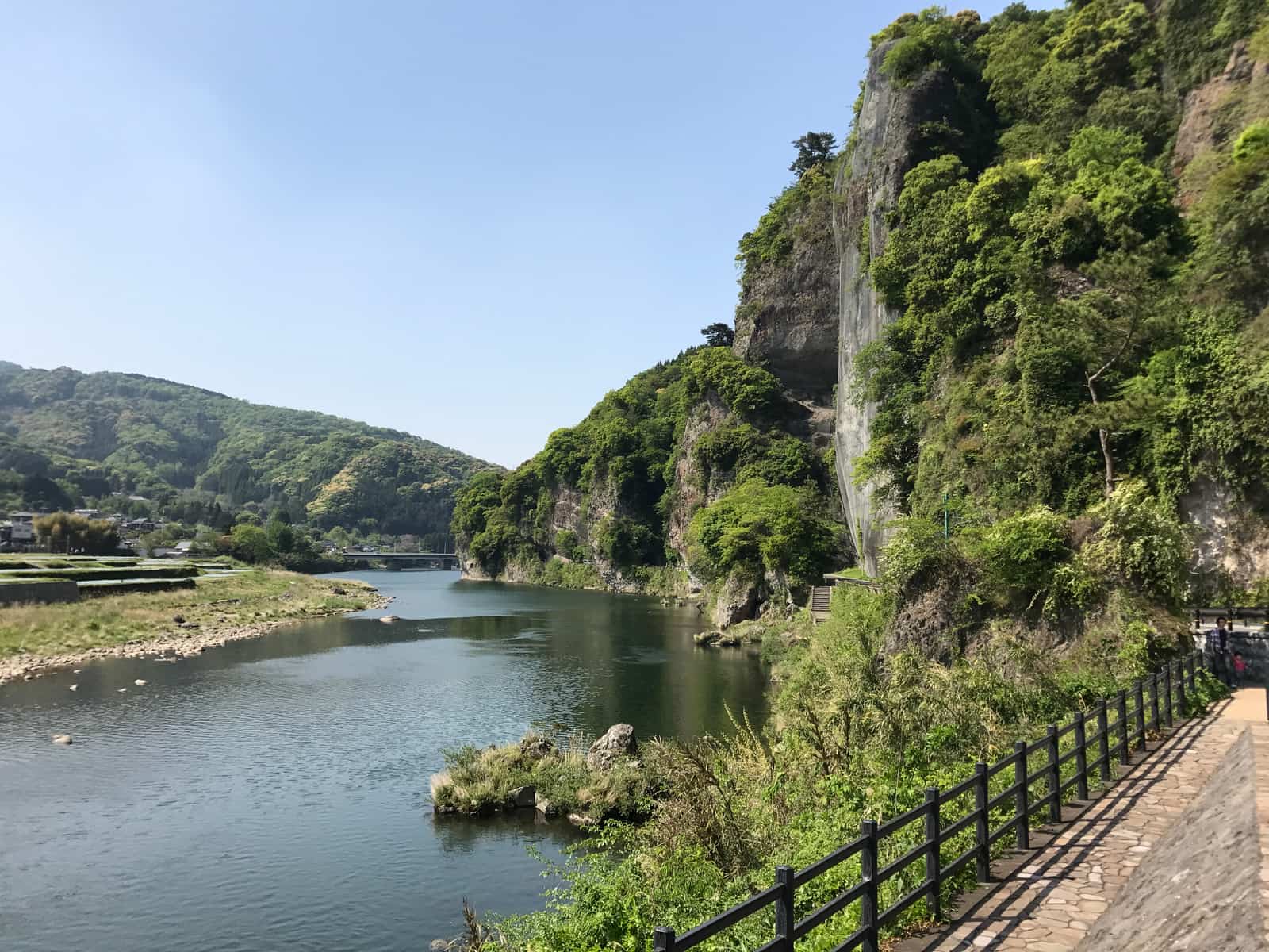
Yabakei itself is the collective name for the gorge landscape along the Yamakuni River basin, split administratively between Nakatsu City in Oita Prefecture (Hon-Yabakei, Shin-Yabakei, Ura-Yabakei and Oku-Yabakei) and part of Kusu Town. It was named by the late-Edo scholar Rai Sanyo and became part of the Yaba-Hita-Hikosan Quasi-National Park in 1950. The area is large, but four points account for almost all real visits:
| Area | Cost | Public transport | What you see, and when |
|---|---|---|---|
| Aonodomon (Hon-Yabakei) | Free to pass, free parking (about 85 cars, 8 large vehicles, 3.6 m limit) | Good — direct bus from Nakatsu Station to "Aonodomon Parking," about 27 min, 7 weekday departures | Hand-cut tunnel and the Kyoshuho cliffs; currently walking only, no vehicles |
| Hitome-Hakkei (Shin-Yabakei) | Free viewpoint, open 24 hours; free parking (256 cars, 11 buses) | Poor — transfer at Kakisaka, about 1.5 hours, no weekend service | Rock pinnacles ringing the viewpoint; autumn colour typically early to mid November |
| Yabakei Bridge (Oranda-bashi) | Free to cross and visit | Poor — no direct service verified for this guide; a driving detour in practice | Japan's only eight-arch stone bridge and its longest stone arch bridge at 116 m; national Important Cultural Property since 2022 |
| Sarutobi Senbotsukyo (Oku-Yabakei) | Free walk; car parks along National Route 500 | Poor — drivers only in practice | Nationally designated natural monument potholes, walking path under 1 km; Marinkyo and Nenbutsu Bridge downstream |
That table sums up Yabakei's character: the views are free, but the transport is the cost. Only one of the four sights is genuinely friendly to travellers without a car; the other three are, in practice, for drivers. That single fact runs through the rest of this guide and is why the verdict at the end comes in two versions.
Aonodomon and the monk Zenkai: 30 years and a novel
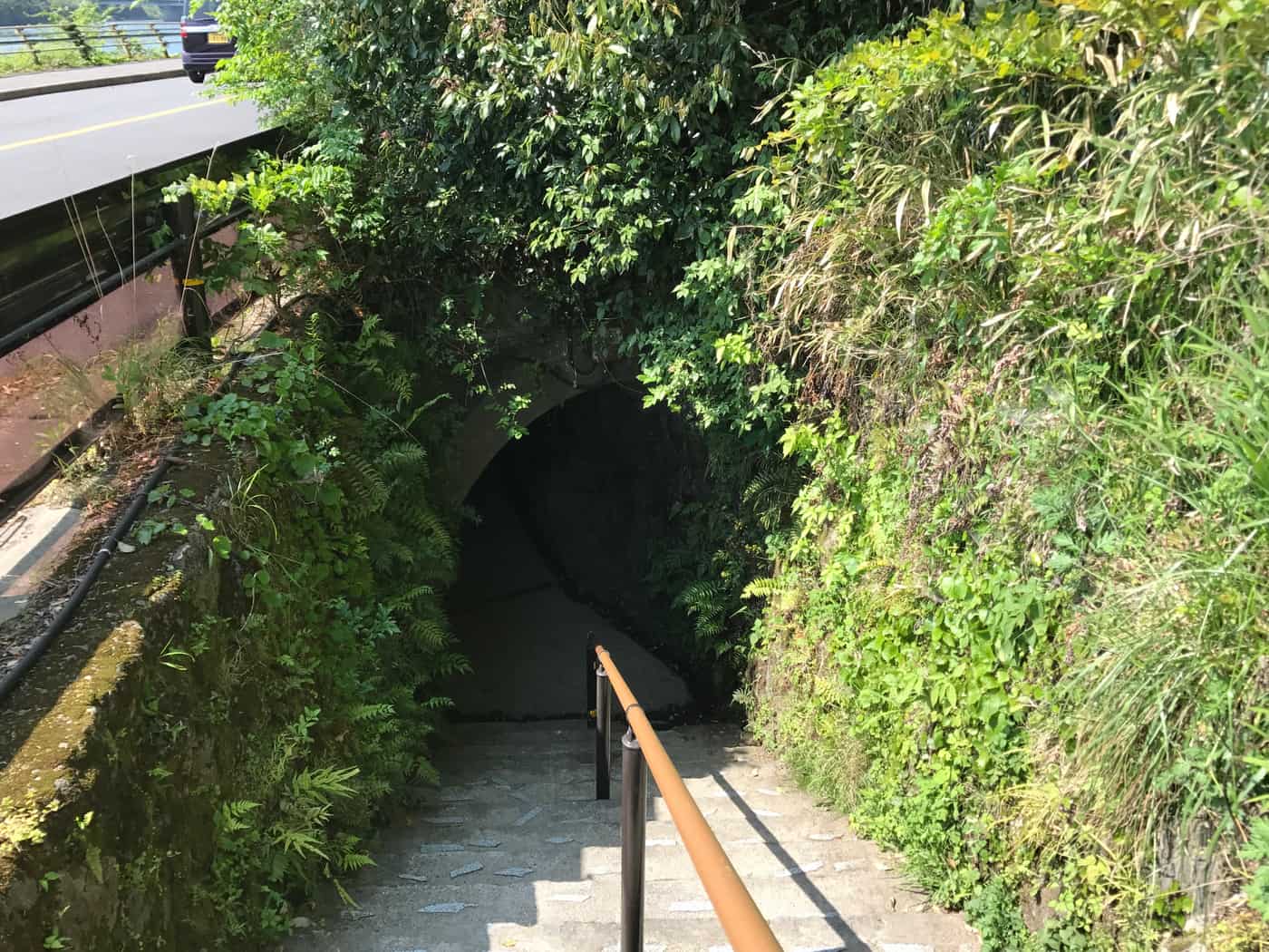
If Yabakei gets only one stop from you, make it Aonodomon — not because it is the prettiest, but because it is the one with a story attached.
The man who cut it was Zenkai, personal name Fukuhara Ichikuro, born in 1687 and died in 1774, the son of a retainer of the Echigo Takada domain and a Soto Zen monk of the mid-Edo period. Passing through on pilgrimage, he found a stretch of sheer cliff above the Yamakuni River where travellers had to edge along chains and plank walkways bolted to the rock, and where people and pack horses regularly fell to their deaths. He resolved to cut a safe road straight through the rock by hand.
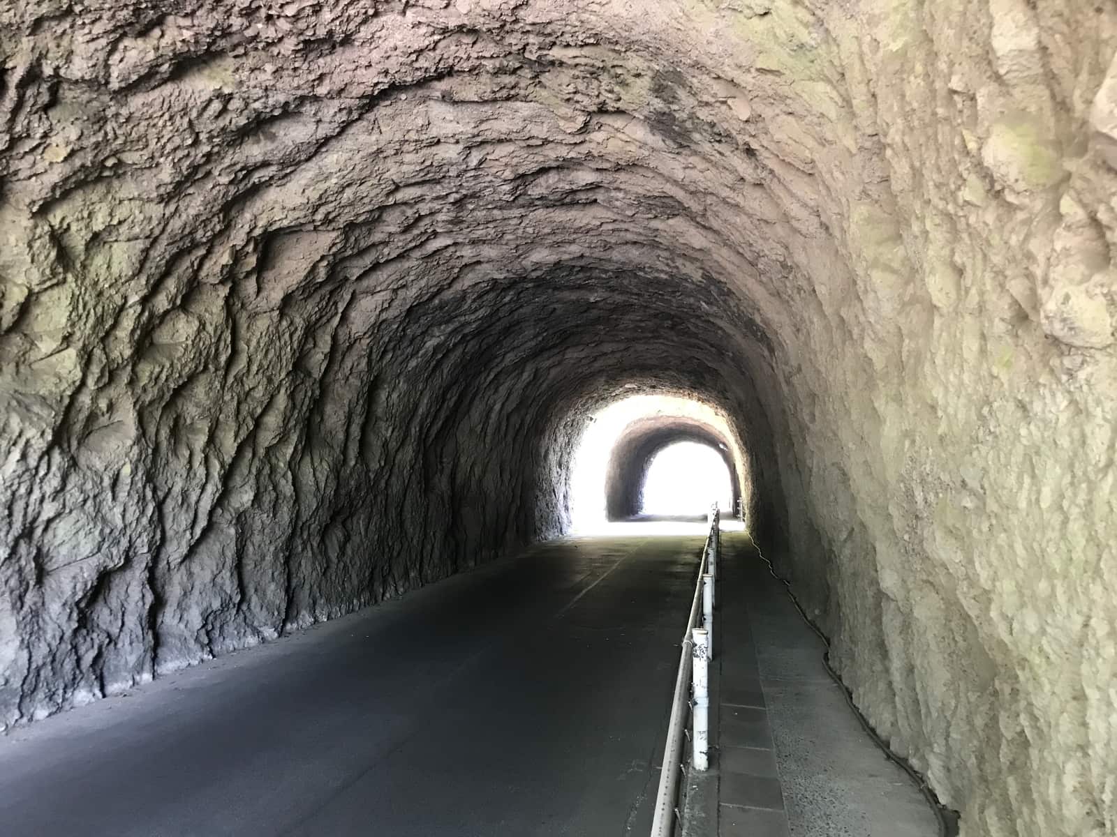
Per the official account of the Nakatsu Yabakei tourism association, work began in 1735 and finished in 1764 — a little over 30 years. The passage as opened is recorded at 2 jo high, 3 jo wide and 308 paces long, which works out to roughly 342 metres in total including about 144 metres of tunnel. One point of transparency: secondary sources give a slightly different set of start and completion years. This guide follows the official tourism-association version throughout and leans on "about 30 years," the figure both accounts agree on, rather than taking sides on the exact dates.
A detail that often gets quoted: Aonodomon once charged a toll in the Edo period — 4 mon per person and 8 mon per ox or horse — which is why it is described as one of Japan's earliest toll roads. That is a historical statement, not a current arrangement. Today it costs nothing and there is no toll booth. The contrast between "Japan's first toll road" and "now completely free" is a nice piece of trivia to carry in with you.
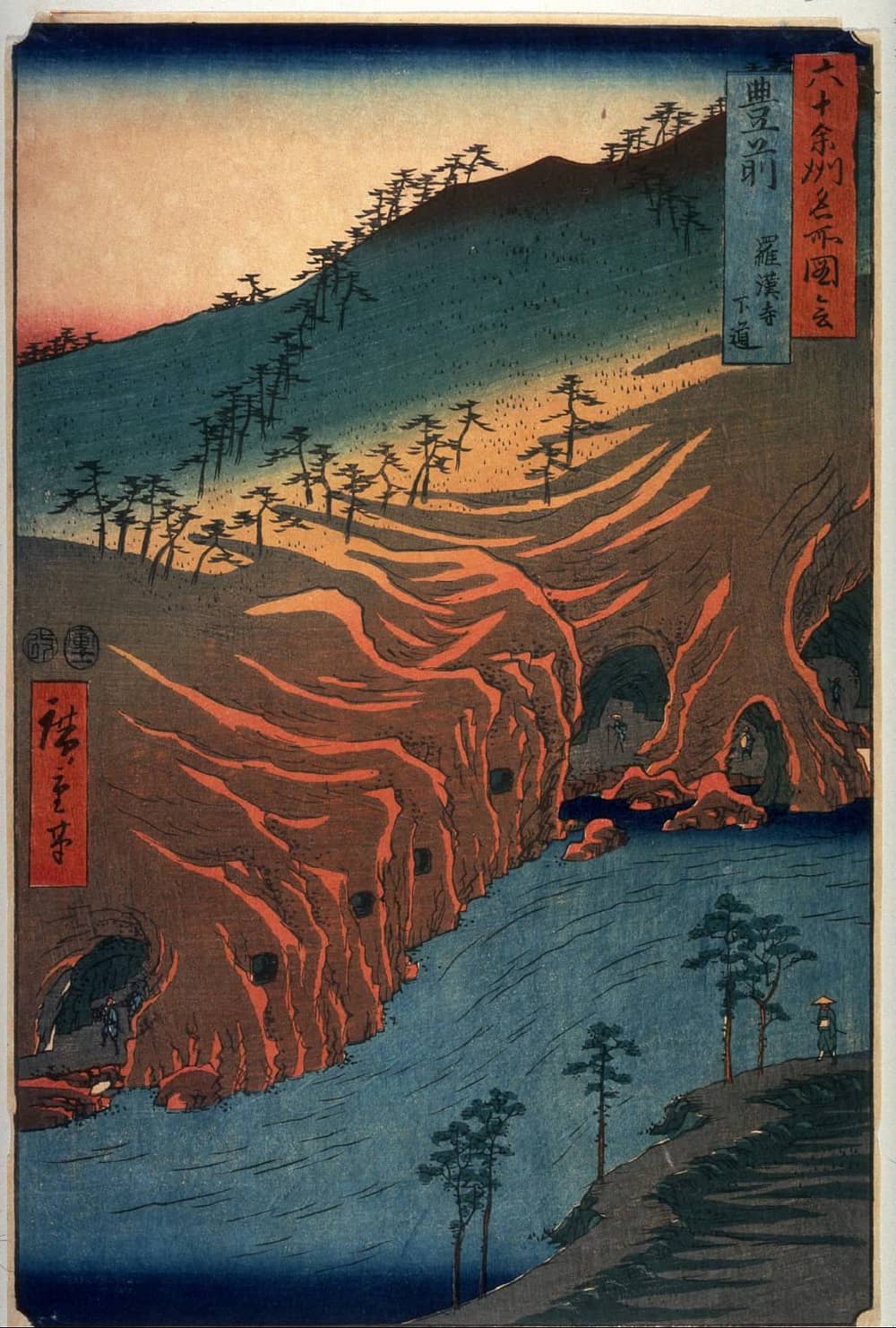
What actually made Aonodomon nationally famous was literature. Kikuchi Kan's 1919 novel "Onshu no Kanata ni" took Zenkai as the model for a monk named Ryokai, using the act of carving the tunnel as an act of atonement in a story about revenge and forgiveness. After the novel took off, Yabakei went from a regional beauty spot to a national name — arguably one of the earliest content-marketing successes in Japanese tourism history. Do keep in mind that the novel is fiction: Ryokai's name and the plot are not a documentary record of Zenkai's life.
My honest read: Aonodomon is worth seeing, but it rewards context. Approached cold as "a tunnel in a cliff," the visual impact is not top tier. Once you know that every chisel groove represents part of a roughly 30-year obsession with making sure nobody else fell, walking through it feels entirely different. It is one of those places where knowing the story doubles the value — which is exactly why the enforced switch to walking suits it.
Hitome-Hakkei: a free, 24-hour rock-pinnacle viewpoint
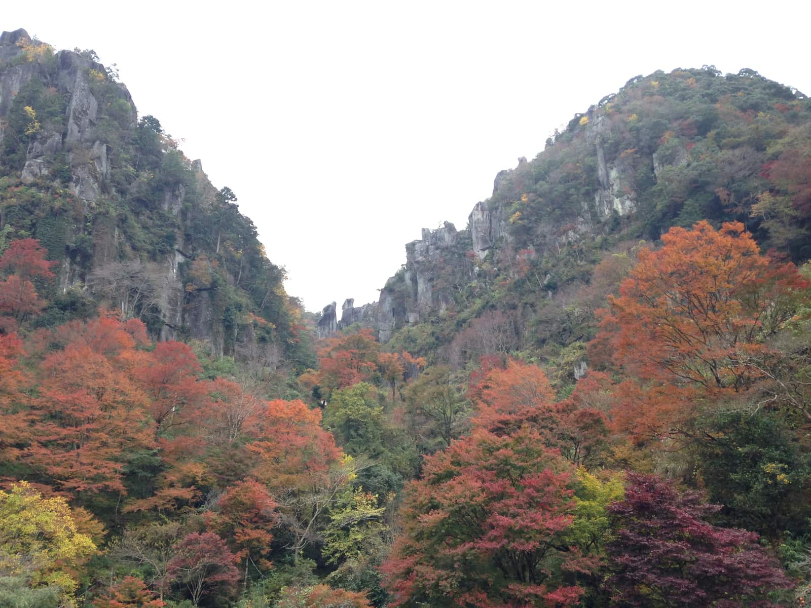
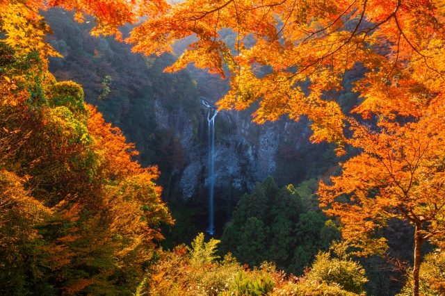
If Aonodomon is the story, Hitome-Hakkei is the visual payoff. It sits in Shin-Yabakei, and the name means roughly "eight views at a glance": stand on the deck and the surrounding columnar pinnacles line up in one sweep. That structure — no climb, a few minutes on foot to a fixed point, the whole panorama delivered at once — makes it unusually good for travelling with older parents or small children.
Two very generous conditions apply: the viewpoint is entirely free and usable 24 hours, with no gated opening times, and the adjacent public car park is free as well, at 256 standard spaces plus 11 bus bays. That car-park size is a clue, incidentally — this is one of the biggest crowd magnets in Oita during autumn colour, and 256 spaces do fill on November weekends. The flip side of having no gate hours is that arriving early, just as the sun clears the ridge, gets you thin crowds and better light. That is the first practical tip I would give anyone.
The tourism association is at pains to point out that Hitome-Hakkei is not just an autumn spot: the "wakaba momiji" fresh green from spring into early summer is presented on equal footing with the "nishiki momiji" autumn season. I agree with that framing, and would go further — if you dislike crowds, the fresh-green window is the smarter choice. Same pinnacles, same zero cost, same 24-hour access, an entirely different visitor count.
The one barrier you can probably already guess is getting there, and that gets its own section below.
Yabakei Bridge and Sarutobi Senbotsukyo
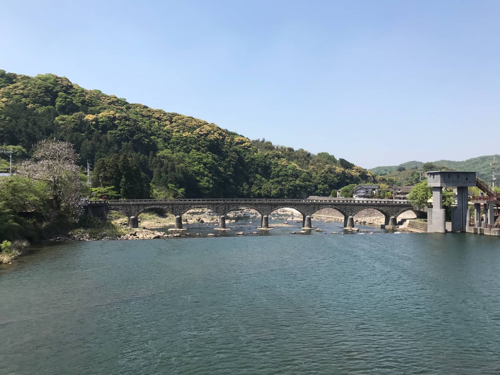
The nickname "Oranda-bashi," Dutch bridge, misleads a lot of visitors, so let us settle it: there is no direct Dutch connection. The bridge uses a horizontal stone-coursing technique of the sort common in Nagasaki Prefecture, distinct from the traditional stone-bridge methods of the Oita and Kumamoto area, and locals gave it a nickname with a foreign ring to match.
The hard facts: construction began in November 1920 and finished on March 29, 1923, to a design by Nagamatsu Noboru of the Nakatsu district civil engineering office. It is the only eight-arch stone bridge in Japan, 116 metres long, which also makes it the country's longest stone arch bridge. On the heritage side it was designated an Oita Prefecture tangible cultural property on March 31, 1981, and then upgraded to a nationally designated Important Cultural Property on September 20, 2022. That upgrade is recent enough that some older introduction pages, official ones included, still describe it as prefecture-designated — do not be thrown if you see the older status quoted.
It functions today as a city road bridge, free to cross and free to photograph. The composition worth walking down to the bank for is the classic one: all eight arches plus their reflection in a single frame.
The other stop worth a detour is Sarutobi Senbotsukyo in Oku-Yabakei, a nationally designated natural monument. Its draw is the pothole topography on the Yamakuni riverbed — water spinning sand and gravel against the rock over centuries has drilled out round hollow after round hollow, hence "senbotsu," the thousand pots. The walking path is short, under a kilometre, and continuing downstream brings you to Marinkyo and the Nenbutsu Bridge. There are car parks along National Route 500, free like everywhere else here.
Sarutobi is much less famous than the other two and gets far fewer visitors. If you are driving and have the time, I would slot it in — it offers a different register of the same landscape: not distant pinnacles to look up at, but water and rock you can crouch down beside. That change of scale is what stops a Yabakei day from feeling repetitive.
The old railway and the cycling road
This is the part of Yabakei most visitors skip, and the part I find most atmospheric.
Yabakei once had its own railway: the Yabakei Railway, opened in 1913 and nicknamed "Yatetsu," running roughly 36 km from Nakatsu Station to Moridome Onsen Station. Per Nakatsu City's own account, it had a glamorous period in the mid-1930s when sightseeing services carried female guides on board. It did not survive the motor age, though: the line closed completely in 1975, and the trackbed was rebuilt as a cycle path in 1982 — today's Maple Yaba Cycling Road.
Because it follows a railway alignment, the gradient is gentle throughout, and the route keeps its railway-era structures: the two Atsugase tunnels and the platform of the old Hirata Station are nationally registered tangible cultural properties, and the stone bridge piers along the line are recognised by the Japan Society of Civil Engineers as modern civil-engineering heritage. Riding through a rail tunnel and past a disused platform gives you a peculiar sense that the trains never really left — a big bonus for anyone who enjoys abandoned-railway routes.
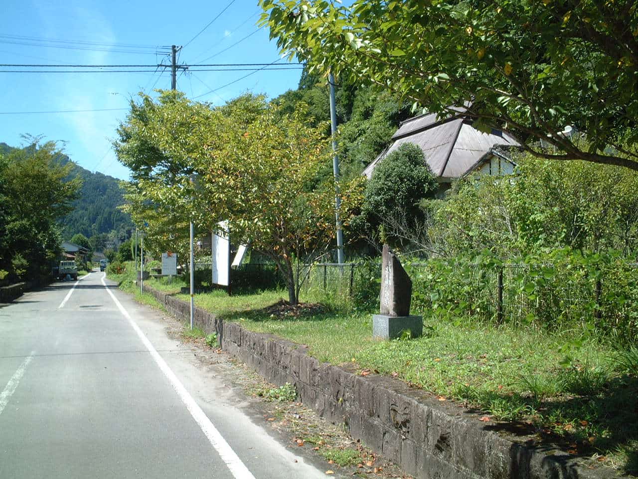
On rentals, one principle matters: no quoted rates here. The Nakatsu City official page, last updated September 30, 2025, states outright that fares and opening hours must be confirmed directly with each facility, so I will not repeat the figures floating around online, most of which are stale. What I will give you is the officially listed set of rental points:
- Aonodomon Cycling Center Fusuien (Hon-Yabakei-machi Sogi 1702-1, 0979-52-2108): 8:00 to 17:00, open year-round, but the city notes it may be unstaffed, so phone ahead.
- Yaba Topia (0979-52-3030): weekends and public holidays only, 10:00 to 14:00.
- Yabakei Cycling Terminal (Yabakei-machi Kakisaka 353, 0979-54-2700): reception 8:30 to 16:00, closed Wednesdays; from December to February closed Tuesdays and Wednesdays.
- Yasuragi-no-Sato Yamakuni (0979-62-2186).
The practical advice writes itself: call before you count on cycling. Of the four outlets, one opens only on weekends and holidays, one has a regular closing day that doubles up in winter, and one may have nobody on duty. That pattern means turning up on spec has a meaningful failure rate. One phone call the day before saves you an afternoon of frustration.
Access, honestly: what you can and cannot reach
Yabakei's transport situation splits sharply in two: Aonodomon is easier to reach than you would expect, while Shin-Yabakei is effectively car-only. Saying that plainly is far more useful than a vague line about the area being "a little inconvenient."
Bus to Aonodomon: workable, and smoother than expected
From JR Nakatsu Station, the Oita Kotsu (Daiko Hokubu) service toward Moridome Onsen runs direct with no transfer to the "Aonodomon Parking" stop, taking about 27 minutes. As verified in July 2026, there are 7 weekday departures from Nakatsu Station: 8:00, 9:00, 10:10, 11:40, 13:30, 15:00 and 17:00. For a rural Japanese bus route, that frequency is genuinely usable.
Two practical notes. First, the bus is cash only, and on-board change is limited to notes of 1,000 yen or smaller — do not board with a 10,000-yen note and do not expect to tap an IC card. Second, this guide deliberately does not quote a fare: verification turned up no auditable official fare source, and quoting an unverifiable figure that may already be out of date would mislead your budgeting more than it helps. Treat the fare table on the bus as authoritative. By the same logic I am not inventing return departure times: photograph the timetable on the stop sign when you get off. It takes five seconds and removes the risk of an hour on a rural roadside.
Bus to Hitome-Hakkei and Shin-Yabakei: marginal on weekdays, impossible on weekends
Here is the part that needs saying bluntly. Getting from Nakatsu Station to Hitome-Hakkei means changing buses at Kakisaka, with a total journey of about 1 hour 30 minutes, the nearest stop being Shin-Yabakei Onsen. And the decisive detail: that connecting route operates on weekdays only and does not run on weekends or public holidays.
Which means, in plain terms: if your trip falls on a weekend and you have no car, Shin-Yabakei is off the table. Not "harder" — the official bus simply does not run. Plenty of introductions describe Hitome-Hakkei as reachable by public transport, which is what happens when you read only the weekday timetable, and anyone planning off that will find themselves stuck at Nakatsu Station.
There is one back-door option: Kusu Kanko buses into Shin-Yabakei from JR Bungo-Mori Station on the Kyudai Main Line, in Kusu Town. But services are limited and weekday and weekend timetables differ, so I would not build a plan around it unless you happen to be travelling along that line anyway. For reference, Bungo-Mori Station to Shin-Yabakei is about 30 minutes by car.
Driving: this is Yabakei's home turf
| From | Time | Notes |
|---|---|---|
| Nakatsu IC, Higashi-Kyushu Expressway (Oita side) | about 20 min | You are in the Yabakei area straight off the ramp |
| Buzen IC, Higashi-Kyushu Expressway (Fukuoka side) | about 20 min | The main exit if you come from the Fukuoka side |
| Fukuoka Airport | about 1 hr 27 min | Routing estimate |
| Kokura Station | about 1 hr 50 min | Expressway or surface roads |
| JR Bungo-Mori Station to Shin-Yabakei | about 30 min | The Kyudai Main Line approach |
That "about 1 hour 27 minutes from Fukuoka Airport" figure tends to reset people's mental map — Yabakei is not as far from Fukuoka as it feels. If your trip is fly into Fukuoka, rent a car, tour northern Kyushu, Yabakei is a very logical first-day or last-day insertion: under 90 minutes from the airport, every sight free, parking free. For the Fukuoka end of that itinerary, see the Fukuoka guide.
One caveat for drivers: as covered above, you cannot currently drive through Aonodomon itself, so the routine is park in the free lot, then walk. That does not dent the wider case for driving. The real advantage is being able to chain Aonodomon, Hitome-Hakkei, Yabakei Bridge and Sarutobi Senbotsukyo, each 20 to 30 minutes from the next — which is precisely what a car-free visitor cannot do.
Autumn and the underrated fresh-green season
Yabakei has a real name on the Kyushu autumn map, but this guide deliberately does not make foliage the centrepiece — the cross-Kyushu comparison of peak timing and route building lives in the Kyushu autumn guide. What you need here is the timing framework for Yabakei itself.
Per the Nakatsu Yabakei tourism association pages and travel-media roundups, Hitome-Hakkei typically peaks in early to mid November. The framing matters: the official page does not commit to specific dates, referring only to a "nishiki momiji" colouring season, so early-to-mid November is a multi-year seasonal feel, not a fixed window for any particular year. Peak colour routinely shifts a week or two either way with the autumn temperature trend, so re-checking about two weeks before you travel is the reliable move.
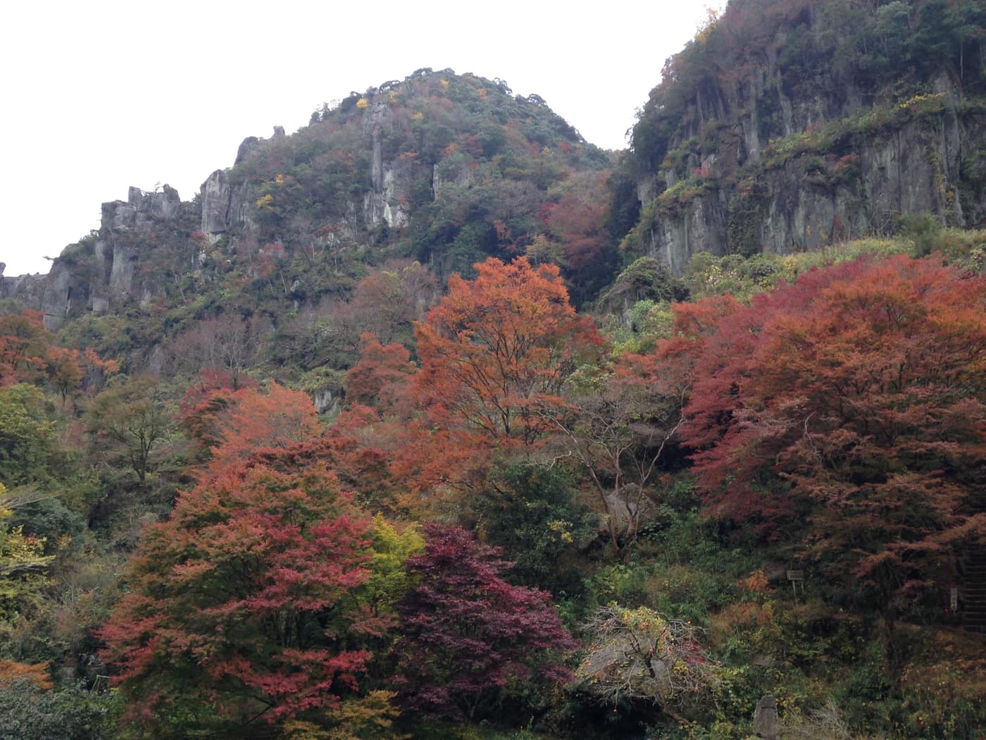
What gets discussed far less is the other three seasons. The tourism association explicitly promotes the "wakaba momiji" fresh green from spring into early summer alongside the autumn season. My take is unambiguous: unless you specifically want autumn colour, the fresh-green season beats it. The substance of Yabakei is rock — pinnacles, cliffs, stone bridges, potholes — and all of that is there year-round; foliage just changes its coat. In the green season the crowds thin out, you are not fighting for a parking space, and the mountain soba places do not have a queue, so the overall experience is arguably better. If you are chasing maximum autumn colour nationally, the sequencing logic is in the Japan autumn foliage guide.
One honest note to close the section: verification for this guide found no officially announced illumination events or festivals with confirmed dates at Yabakei. If you see specific event dates quoted elsewhere, confirm them with the organiser directly — this guide does not repeat event information it cannot verify.
What to eat and buy: soba, Nakatsu karaage, makigaki
Food around Yabakei needs splitting into two layers: what you can eat up in the gorge at Hitome-Hakkei, and what to eat and buy in central Nakatsu on the way back. Those two often get blended together in write-ups, leaving readers with the impression that Nakatsu's famous fried-chicken shops are at the scenic spots. They are not — central Nakatsu is roughly 25 to 40 minutes by car from the main Yabakei sights, which makes it a return-leg stop.
Inside the Hitome-Hakkei area: two soba options
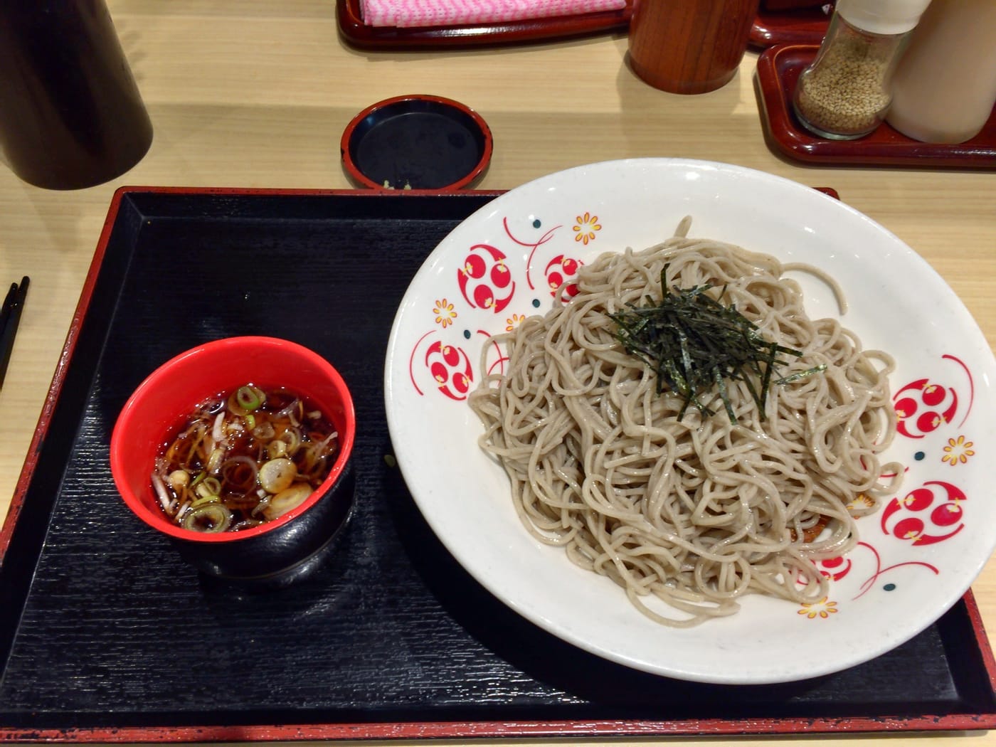
- Rokumeikan observation restaurant (3152-4 Shin-Yaba, Yabakei-machi, Nakatsu, Oita (map), 0979-55-2025): right at the Hitome-Hakkei viewpoint, with a second-floor dining area facing the rock formations, and hand-cut soba made by the owner. Per the tourism association, hours run from a little after 11:00 to 17:00, closing earlier at 15:00 when the attached inn has guests. Two details matter: it has irregular closing days and no car park of its own, so a wasted trip is possible and you will be parking in the public lot and walking over.
- Chadokoro Senkeibo (Senkei-no-yu) (3155-3 Shin-Yaba, Yabakei-machi, Nakatsu, Oita (map), 0979-55-2052): by the Shin-Yabakei public car park, serving hand-cut soba from home-grown, home-milled buckwheat, in both a 100 percent buckwheat version and a 28 percent blend. Soba is served 11:00 to 17:00 and the baths run 11:30 to 19:00; closing days are irregular, and you park in the Shin-Yaba public lot.
I am not going to pretend to have eaten at either and hand you a score. What the official listings do tell you is that both combine hand-cut soba with a scenic position, a very typical mountain-tourism pairing. The practical takeaway is that both close irregularly, so have a plan B for lunch, or simply push the meal back to central Nakatsu.
On the way back: Nakatsu karaage
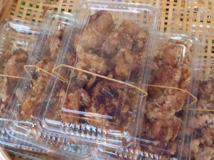
Nakatsu is one of Japan's recognised capitals of karaage, Japanese fried chicken, which is reason enough to stop on the return leg. Two shops with award records you can actually check:
- Bungoya main shop (853 Bungo-machi, Nakatsu, Oita (map); 0979-22-8104): 9:00 to 18:00, closed Sundays. It began as a butcher over half a century ago and has specialised in karaage for forty years, with six consecutive gold prizes at the Karaage Grand Prix. Note the Sunday closure — it catches a lot of weekend visitors out.
- Nakatsu Karaage Senmonten Genkiya main shop (35-2 Kanate, Nakatsu, Oita 871-0013 (map); 0979-24-1933): 11:00 to 21:00, closed only January 1 to 3, with seven consecutive gold prizes at the Karaage Grand Prix. Open until 9 pm and essentially year-round, it is the easier one to fit around a flexible itinerary.
To repeat the point: both are in central Nakatsu, not in the Yabakei scenic area, about 25 to 40 minutes by car from the main sights. Slot them in as a stop after you come down, on the way back to Nakatsu Station or the expressway.
Souvenir: makigaki, November and December only
For something to take home, the local signature is makigaki, a traditional Nakatsu confection dating back to the Edo period, made by processing persimmons and rolling them into a log. The name to look for is Keigetsudo: the main shop is at 795 Nakamachi, Nakatsu, Oita (map), and the Okidai branch at 1-3-51 Okidai-machi, Nakatsu, Oita (map) (9:30 to 19:00, closed only on January 1).
There is a hard constraint, though: makigaki is a seasonal product sold only in November and December, while stocks last. Come in summer and you can strike it off the shopping list entirely. Come during autumn colour in early-to-mid November, on the other hand, and the timing lines up exactly with the selling window — a small seasonal dividend.
Is Yabakei worth a special trip? Drivers vs the car-free
With everything on the table, the answer is clear-cut, but it has to be given twice.
- If you are driving: yes, and half a day to a full day is the right allocation. With a rental car in northern Kyushu or Oita there is very little reason to skip it — about 1 hour 27 minutes from Fukuoka Airport, 20 minutes off the ramp at Nakatsu IC or Buzen IC, four areas that cost nothing, parking that costs nothing. Concretely, I would run it like this: morning at Aonodomon (park, walk the open section, look properly at the chisel work — around an hour), 20 to 30 minutes to Shin-Yabakei for the Hitome-Hakkei viewpoint plus a mountain soba lunch (about 1.5 hours), then in the afternoon pick either Yabakei Bridge (essential if stone bridges are your thing) or Sarutobi Senbotsukyo (if you would rather see water and rock up close), and finish with karaage back in central Nakatsu. That is a full day; compressed, it still delivers Aonodomon and Hitome-Hakkei in half a day. To extend it into a two-day inland Oita loop, add the Kokonoe Yume suspension bridge guide.
- If you are car-free: take Aonodomon alone and leave the rest. The direct bus from Nakatsu Station — about 27 minutes, 7 weekday departures — is a decent proposition, and combined with central Nakatsu (karaage, Keigetsudo) it makes a solid half day. Shin-Yabakei is where I would talk you out of it: a weekday transfer at Kakisaka and 1.5 hours each way, and no service at all on weekends and holidays. If your dates land on a weekend, my advice is unambiguous — do not force Hitome-Hakkei into the plan. Do Aonodomon as a single stop, or give the day to somewhere with smoother access, rather than betting it on a bus that is not running.
Step back and Yabakei's place among Kyushu attractions is the low-cost, high-story-density category. There are no lavish facilities, no must-buy tickets, no reservation-only experiences. What it offers is a tunnel cut through rock over roughly three decades, the only eight-arch stone bridge in Japan, a free rock-pinnacle viewpoint open around the clock, and a gentle cycle path built on a dead railway. If your travel satisfaction comes from knowing what happened somewhere, the return on investment here is high. If you want thrill rides and set-piece photo stops, it will read as plain.
And once more, the thing that matters most: Aonodomon's access status is live and changing. This guide reflects the Nakatsu City notice as updated on June 24, 2026 — walking reopened, vehicles still banned, no reopening timetable. Check city-nakatsu.jp or nakatsuyaba.com yourself before you set out. One minute of homework beats arriving at a closed barrier.
Frequently Asked Questions
- Q1:Is there an admission fee for Yabakei, and what about parking?
- No, and this is the single best thing about Yabakei. The headline natural sights are all free to visit: passage through Aonodomon, the Hitome-Hakkei viewpoint in Shin-Yabakei, the Yabakei Bridge (the "Dutch bridge"), and the Sarutobi Senbotsukyo gorge in Oku-Yabakei. Parking is free too — the public car park at Aonodomon takes roughly 85 standard cars plus 8 large vehicles with a 3.6 m height limit, and the Hitome-Hakkei public car park holds 256 standard cars plus 11 buses. The Hitome-Hakkei viewpoint is also open 24 hours with no gated hours. Compared with the ticketed gardens and theme parks elsewhere in Kyushu, a day at Yabakei costs you transport and lunch and essentially nothing else.
- Q2:Can you visit Aonodomon right now? What is the 2026 status?
- You can walk it, but you cannot drive it. The city road through Aonodomon was closed to all traffic, pedestrians included, after a rock-face collapse in November 2024. From 10:00 on April 1, 2026 the ban on pedestrians was lifted, opening roughly a 750-metre section from the National Route 212 junction to the area around Ao-no-Zenkai Bridge, with a detour through the hand-carved tunnel on the Sogi side needed to get all the way through. Vehicles remain fully banned. New rockfall was found in March 2026, Nakatsu City is still working out countermeasures, and the notice, last updated on June 24, 2026, gives no timetable for reopening to traffic. This is a live disaster-recovery case, so check the city site (city-nakatsu.jp) for the current notice before you travel.
- Q3:Can you reach Shin-Yabakei and Hitome-Hakkei without a car?
- On a weekday, barely. On a weekend, effectively no. Getting from JR Nakatsu Station to Hitome-Hakkei means changing buses at Kakisaka, with a total journey of about 1 hour 30 minutes, and the key catch is that the connecting route runs on weekdays only and does not operate on weekends and holidays. Aonodomon is a completely different story: there is a direct bus from Nakatsu Station to the "Aonodomon Parking" stop, about 27 minutes, roughly 7 departures a day on weekdays, no transfer. There is also a back-door route from JR Bungo-Mori Station on the Kyudai Main Line using Kusu Kanko buses, but services are limited and weekday and weekend timetables differ, so do not build a plan on it. By car it is about 20 minutes from either Nakatsu IC or Buzen IC on the Higashi-Kyushu Expressway.
- Q4:When is the best time for autumn leaves at Yabakei?
- Based on the Nakatsu Yabakei tourism association pages and travel-media roundups, peak colour at Hitome-Hakkei typically falls in early to mid November. An important caveat: the official page itself does not commit to any specific dates, describing only a "nishiki momiji" colouring season, so treat early-to-mid November as a seasonal feel rather than a fixed date for any given year — it shifts by a week or two with the autumn temperature trend, and you should re-check about two weeks out. Worth knowing too: the operator stresses Yabakei is not autumn-only. From spring into early summer the "wakaba momiji" fresh green is the draw, and the same viewpoint costs nothing and never closes.
- Q5:Was Aonodomon really dug by hand?
- Yes. Zenkai, a Soto Zen monk of the mid-Edo period (born 1687, died 1774, the son of a retainer of the Echigo Takada domain, personal name Fukuhara Ichikuro), saw travellers and pack horses falling to their deaths from the cliff path along the Yamakuni River and vowed to cut a safe road through the rock by hand. Per the official version from the Nakatsu Yabakei tourism association, work began in 1735 and was completed in 1764, taking a little over 30 years. The passage as originally opened is recorded at 2 jo high, 3 jo wide and 308 paces long, working out to roughly 342 metres in total with about 144 metres of tunnel. The story became the basis for Kikuchi Kan's 1919 novel "Onshu no Kanata ni," which made Yabakei famous nationwide — though note the novel's monk protagonist Ryokai is a fictionalised character, not a documentary account of Zenkai.
- Q6:Why is Yabakei Bridge called the "Dutch bridge"? Is there a Dutch connection?
- There is no direct Dutch connection — it is a popular nickname. The bridge was begun in November 1920 and completed on March 29, 1923, designed by Nagamatsu Noboru of the Nakatsu district civil engineering office. It uses a horizontal stone-coursing technique of the kind common to the stone bridges of Nagasaki Prefecture, unlike the traditional stone-bridge methods around Oita and Kumamoto, which earned it the "Oranda-bashi" nickname. It is the only eight-arch stone bridge in Japan and, at 116 metres, the longest stone arch bridge in the country. It was designated an Oita Prefecture tangible cultural property on March 31, 1981, and upgraded to a nationally designated Important Cultural Property on September 20, 2022. Today it is a city road bridge, free to cross and to visit.
- Q7:Can you do Yabakei in a day, and how should you plan it?
- There is no official recommended visit length, but the verified transport data lets you work it out. With a car, the two headline stops are Aonodomon (the walking section plus the Kyoshuho cliff scenery around it) and Hitome-Hakkei in Shin-Yabakei; they sit roughly 20 to 30 minutes apart, so half a day to a full day covers both plus a detour to Yabakei Bridge. Without a car, the weekday transfer of 1.5 hours and the weekend suspension mean the sensible plan is to collapse the itinerary down to Aonodomon plus central Nakatsu and not attempt Shin-Yabakei at all. That is an inference from verified transport data, not an official itinerary recommendation.
- Q8:Can you rent a bicycle for the Yabakei cycling road, and how much is it?
- You can rent, but ask each outlet for the rate. The Maple Yaba Cycling Road runs on the trackbed of the Yabakei Railway, which closed in 1975 and was converted into a cycle path in 1982. The Nakatsu City official page, last updated September 30, 2025, states plainly that fares and opening hours should be confirmed directly with each facility, so this guide does not quote a figure. The four officially listed rental points are: Aonodomon Cycling Center Fusuien (Hon-Yabakei-machi Sogi 1702-1, 8:00 to 17:00, open year-round but sometimes unstaffed, so call 0979-52-2108 first); Yaba Topia (weekends and holidays only, 10:00 to 14:00, 0979-52-3030); Yabakei Cycling Terminal (Yabakei-machi Kakisaka 353, reception 8:30 to 16:00, closed Wednesdays, and closed Tuesdays and Wednesdays from December to February, 0979-54-2700); and Yasuragi-no-Sato Yamakuni (0979-62-2186).
Read next
Kyushu Autumn 2026: Mifuneyama, Unzen & Yabakei Guide
Mifuneyama 2026 illumination dates are out — Kyushu foliage is scattered, so here is the drive-vs-rail verdict.
Kokonoe Yume Bridge: Japan's Highest Footbridge Guide
Still Japan's highest pedestrian bridge at 173m — no longer its longest. The ticket math, the November last-entry trap, and the car-free ¥7,600 Nishitetsu package.
Is Kumamoto Castle Open? 2026 Quake Status, Tickets & Hours
Kumamoto Castle reopened on 13 August 2026, but Wakuwakuza is closed, combo tickets are off sale and one car park is shut — tickets, hours and Shiro Akari.
📊 See the 2026 Price Index (JR Pass, DPA, eSIM, Airport Transport) →